

Along the Bonneville Shoreline Trail for a short bit before getting onto the Great Western Trail.
Along the Great Western Trail, looking up at Thurston Peak, center.
Many, many short switchbacks up a ridgeline to the northwest of Thurston Peak.
Overall the trail was in really good shape.
Except for maybe a few brushy sections, which really weren't bad at all.
A view of Layton Peak, a peak north of Thurston Peak. Finally, a view of a mountain instead of just trees. I actually had no idea what this route would look like before this point and was happily surprised to see the cliffy face ahead.
Another shot of Layton Peak to the south. Layton Peak itself is actually the green hill to the left of the cliffy stuff.
Looking back the way I came, way down there.
Entering the meadows to the north of Layton Peak.
The Great Western Trail continues through a really pretty meadow.
Layton Peak and its interesting little cirque ahead.
Looking back through the meadows.
The Great Western Trail heads into the cirque, then works up a short section of Class 2 to just left of the cliffy stuff in the center.
Approaching the cirque.
At the top of the short Class 2, looking back across the meadow I came from. The green hill in the center is North Layton Peak, the third peak I'd do along the ridgeline later today.
At the top of the cliffy stuff, I continued through the meadows toward Thurston Peak, which is finally visible in the center.
The Great Western Trail faded out for a little bit through this meadow, but I was able to pick it up shortly after.
Great Western Trail continues around the west side of Thurston Peak.
Looking back toward Layton Peak and the meadows I passed through.
On the west side of Thurston Peak. I left the Great Western Trail and followed a social trail up to the summit.
Looking back down the west ridge of Thurston Peak.
A view south toward Francis Peak, almost at the summit of Thurston Peak.
Thurston Peak summit, view south.
Thurston Peak, view north. I decided to continue along the ridge.
Looking back toward Thurston Peak as I navigated a short bouldery Class 2 section along the ridge.
Layton Peak ahead.
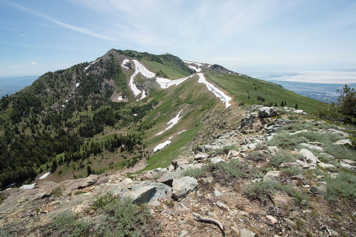
Looking back toward Thurston Peak.
North Layton Peak ahead.
View back toward Layton Peak.
Continuing along the ridgeline, only some super minor bushwhacking.
Almost on the summit of North Layton Peak, looking back toward Layton Peak (left) and Thurston Peak (center).
North Layton Peak summit, view north toward Ogden Peak.
North Layton Peak summit, view west. I started down this slope. The brush progressively got worse as I got back to the Great Western Trail. It wasn't too bad, but it's worth noting.
Hire me or show me some love!
Hire/refer me as a web developer or send me a few bucks if you find my site useful. I’m not sponsored, so all fees are out-of-pocket and my time preparing trip reports is unpaid. I really appreciate it!