I provide a free route map, but you can also download a hike/drive GPX to assist you and to help support my site. Before sharing my GPX tracks with others, please remember my site is a free resource and I'm charging nominal fees to offset my substantial costs.
GPX track added to your cart.
Jan 10, 2021 — Titus Canyon Road is a beautiful road leading through the Grapevine Mountains. NPS recommends 4WD, but I don't think that it's necessary. I probably could have managed it with a sedan, and I'm usually pretty conservative with driving. However, since Titus Canyon Road is one-way, I don't recommend taking any chances. Anyway, this route to Titus Peak was quite nice, though really short.
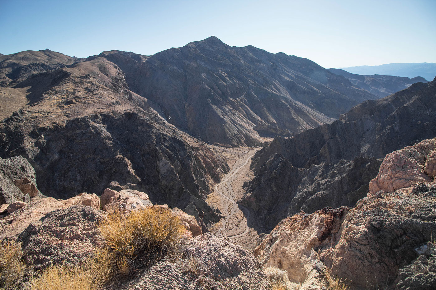
The hike begins just before the road heads through Titus Canyon. I parked at a turn-off and observed the south face of Titus Peak, which was pretty much a sheer cliff. The peak itself isn't really even a peak, more just a high point along the rim of Titus Canyon. I started up a pretty canyon to the north, my plan to wrap around to the north and ascend on easier terrain. There was a short section of wide narrows before the wash opened up. I followed the base of the hills and kept my eyes peeled for a reasonable-looking route on the left to gain the higher ground. You can probably just start up anywhere, the route options starting at Class 4 and slowly becoming less severe the farther up the wash you walk. I was able to locate a Class 2 option just before reaching the north ridge of Titus Peak, but fun Class 3 options do the exist before this point. In fact, on my ascent I pulled a few tougher moves, but I only included my easier descent route in my attached map. You could also wrap all the way around the peak and ascend from the northwest if you don't want to do any scrambling. The Class 2 route I took ascends a gully and brought me directly to the ridge. I headed south up the mellow slope to the summit of Titus Peak. The true high point requires a Class 2 boulder scramble. There was a hint of a view at Mount Palmer to the north, and the views down into Titus Canyon were quite nice. I could even see my car parked below.
I also included some photos of Leadfield, which is a ghost town located along the way to the trailhead, located here: 36.84835, -117.0594. There's a NPS sign for it, so you can't miss it. Apparently the story goes: "This was a mining boom town founded onwild and distorted advertising. 300 people swarmed here..." What a bummer it must have been for those people to find there was nothing here. Oops. Anyway, the ghost town is just off the road and worth checking out. The photos for Leadfield below are from a few years ago when there was snow in Titus Canyon during our visit.
Please consider helping me out if you find my site useful. I'm not sponsored, so all site fees are out-of-pocket and my time preparing these trip reports is unpaid. You can also hire me as a web developer. I really appreciate it!


If you find my site helpful, please help me replace my many broken cameras, fund my website fees (hosting, APIs, security), or just support my countless hours of work. I pay for all expenses myself, and all trip reports I post are unpaid and unsponsored, so any support is really appreciated!
If using PayPal, please select their option for "Sending to a friend" so they don't take out fees, thank you.
My site is free to use, but consider sending me a few bucks to help keep it running. Thanks in advance!