I provide a free route map, but you can also download a hike/drive GPX to assist you and to help support my site. Before sharing my GPX tracks with others, please remember my site is a free resource and I'm charging nominal fees to offset my substantial costs.
GPX track added to your cart.
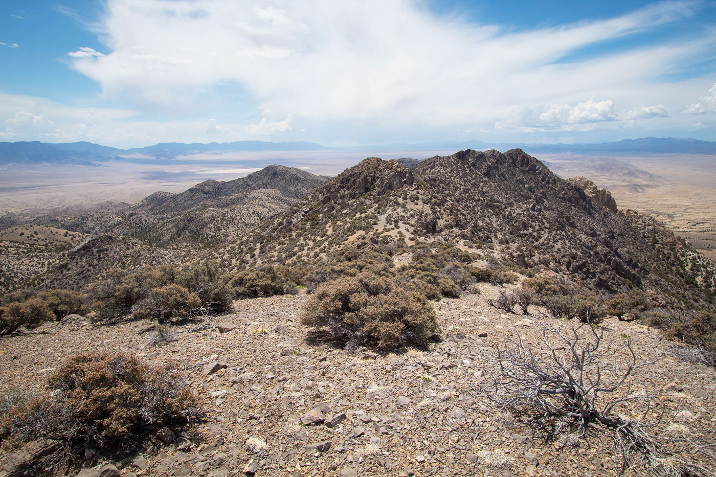
May 17, 2021 — Tunnel Spring Mountain is a remote peak in Utah's West Desert. It's a bit different-looking from other high points in the area, being less forested and with more loose rock than dirt slopes. Leave UT-21 here (38.72249, -113.92532), then bear right here (38.7253, -113.91663). The road fades briefly here (38.74205, -113.83758), but any car can make it down the somewhat steep, short hill and rejoin the road where it becomes obvious again a hundred feet later. Continue northeast here (38.74024, -113.83422) and follow the road to where I parked at a water container of some sort. The road appears to continue on Google, but it's so faint that I didn't feel it was proper to drive on it. I started hiking east toward the range. From here it wasn't clear which of the bumps was the high point, but as I got closer through the desert/grassy terrain I made out a spur ridge that would take me up there.
The spur ridge I headed up was less steep on its northern end, so I headed there rather than directly up its west slope. The first few hundred feet of the ridge ascent was just steep dirt, which slowly introduced some sporadic light Class 2. Once I made it about 2/3 of the way up, the terrain changed significantly. Whereas until this point it was best to stick to the ridge crest, now I found myself trying to interpret a possibly difficult-looking spine of rock along the ridge. I started up what looked like a fun and straightforward option. I marked my initial ascent on the attached map as "Optional Class 3 Section". Keeping to the left avoids this scrambling if that's your preference.
Past this section the terrain became more jumbled. On my ascent, I continued along the ridge crest and found myself on pretty terrifying terrain. I doubt staying along the crest will result in anything easier than Class 5. I backtracked and instead kept to the right of the rocky ridge on somewhat loose scree (Class 2). I kept just below the cliffs that marked the ridge crest until a weakness came into view on the left. This steep, loose Class 2 ascent worked fine, but it wasn't fun by any means. After a hundred feet or so I found myself back on the ridge crest, but past the scary cliffs. It was an easy walk to the summit from here.
Please consider helping me out if you find my site useful. I'm not sponsored, so all site fees are out-of-pocket and my time preparing these trip reports is unpaid. You can also hire me as a web developer. I really appreciate it!


If you find my site helpful, please help me replace my many broken cameras, fund my website fees (hosting, APIs, security), or just support my countless hours of work. I pay for all expenses myself, and all trip reports I post are unpaid and unsponsored, so any support is really appreciated!
If using PayPal, please select their option for "Sending to a friend" so they don't take out fees, thank you.
My site is free to use, but consider sending me a few bucks to help keep it running. Thanks in advance!