I provide a free route map, but you can also download a hike/drive GPX to assist you and to help support my site. Before sharing my GPX tracks with others, please remember my site is a free resource and I'm charging nominal fees to offset my substantial costs.
GPX track added to your cart.
Apr 20, 2023 — Turtlehead Peak is a minor limestone summit within Red Rock Canyon National Conservation Area. It has nice views of the Calico Hills, but is otherwise really only known because there's a popular trail to its summit. It's also known as Turtlehead Mountain to some. You need a Red Rock Canyon reservation to access the Sandstone Quarry Trailhead within the scenic drive, which is the standard starting point for Turtlehead Peak. You could of course also reach this trailhead by making a lengthier hike from the Red Springs Trailhead outside of the scenic loop and avoid the drive and bureaucracy, but I'll leave that for you to decide. The hike starts from Sandstone Quarry along a wide and popular trail that reaches a junction with the Calico Tanks Trail. Keeping left leads up to Turtlehead Peak.
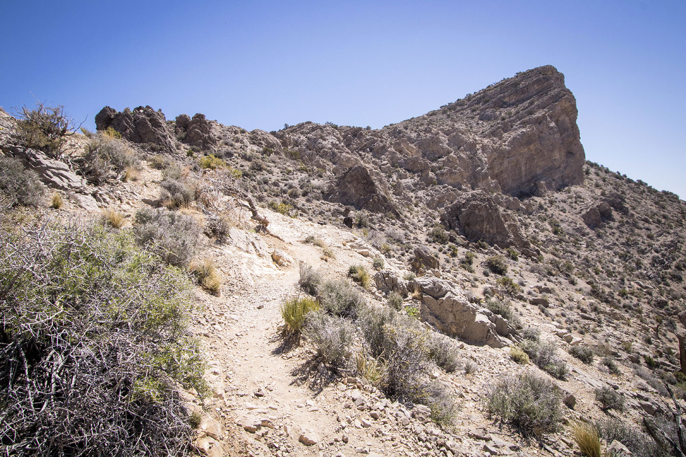
The Turtlehead Peak Trail ascends slowly adjacent to a wash, though many hikers seem to choose to hike within the wash rather than use the trail. Either way is no big deal since signs mark the route quite well. The trail then bends northeast and ascends into brushier terrain, leading toward the base of Turtlehead Peak. It's a striking cliff comprised of sheer limestone, but a bit underwhelming compared to the La Madre Mountains just behind it. Now getting more steep, the trail ascends along the left side of a major drainage on the peak's west shoulder. It might get a bit confusing to stay on the intended trail at times since there are various social trails leading all over the place. It seems the BLM hasn't defined an exact route. Though it helps that there are white dots painted onto rocks to point the intended route, it's easy to skip one and take an alternative social trail. All options seem to lead to the west ridge of Turtlehead Peak, some more directly than others. On the way up the gorgeous peaks of Red Rock Canyon become visible to the south.
The west ridge starts off as a clear trail and passes some few cool formations, but a few hundred feet before the summit it's more of the same confusing web of social trails. I found the most well-worn option doesn't head directly to the peak, but instead wraps beneath it and ascends from the other side. This is nice since there are great views down into the Calico Hills from this direction, but reaching the peak more directly along the ridge crest via one of many trails also seems to be a viable option.
Years ago I did a loop on the backside of the peak, and if you want information about that route get in touch and I can provide some details. I took that old previous trip report down because it wasn't detailed enough to be helpful.
Please consider helping me out if you find my site useful. I'm not sponsored, so all site fees are out-of-pocket and my time preparing these trip reports is unpaid. You can also hire me as a web developer. I really appreciate it!


If you find my site helpful, please help me replace my many broken cameras, fund my website fees (hosting, APIs, security), or just support my countless hours of work. I pay for all expenses myself, and all trip reports I post are unpaid and unsponsored, so any support is really appreciated!
If using PayPal, please select their option for "Sending to a friend" so they don't take out fees, thank you.
My site is free to use, but consider sending me a few bucks to help keep it running. Thanks in advance!