I provide a free route map, but you can also download a hike/drive GPX to assist you and to help support my site. Before sharing my GPX tracks with others, please remember my site is a free resource and I'm charging nominal fees to offset my substantial costs.
GPX track added to your cart.
Nov 19, 2021 — I've spent a fair amount of time in the Whipple Mountains exploring the lower volcanic peaks on the range's east side like this loop, but haven't yet gotten to the range's high point. It just seemed like a big desert lump in comparison to all the super fun craggy little guys down low. Finally I teamed up with a new friend Avery to tackle the Whipple Mountains High Point. He drove eight hours round-trip to hike today, quite the committed peakbagger. The roads on Google Maps aren't correct for reaching the trailhead. Navigate here and turn right onto this powerline road that doesn't appear on the map (34.47237, -114.52023). This road is fine for any car. Follow it generally southeast until here (34.42498, -114.42605) where you should turn right and head south. This is high-clearance road, and will continue to be until the trailhead. Then turn left here (34.37765, -114.45708) and follow War Eagle Mine Road south until it ends.
The plan was to do this hike as an out-and-back, taking the standard route which used drainage on the northwest side of the range, but on the way back I decided to leave the drainage and follow a major ridge to in order to get some more views and an unranked peak along the way. Both options ended up being nice overall.
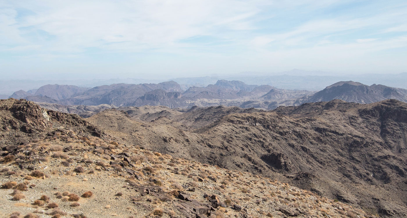
We parked next to some rusty, abandoned cars and took an old mining road past some mining remains before dropping into a major unnamed wash. This wash ultimately leads away from the major drainage used as a standard route for Whipple Mountains HP, so we wanted to be sure not to follow it for too long. We followed the wash for a few miles as it headed south. There were lots of possible off-shoots that lead to lesser washes, so we had to pay attention. Eventually the wash continued southwest and away from the peak, so we left it and entered terrain riddled with little arroyos. We dipped in and out of these arroyos for a little bit before deciding to just stay to the higher ground rather than the slightly annoying terrain. Soon we saw the mouth of the major drainage we'd use to access the peak, so we followed it south. The ridge I'd use later to descend is on the left (east) side, so you can use this time to scope above to see if it looks worthwhile to you.
The drainage had some short Class 2 minor dryfalls and a bunch of interesting slickrock sections. We were expecting a bit more interesting rocks, but neither of us are geologists so maybe we were looking at formations that are more interesting than they appeared. It was a pleasant ascent without too much brush or boulder-hopping and we soon found ourselves ascending out of the drainage and onto a wide and mellow slope at the base of the Whipple Mountains High Point. This is the point where I'd divert to head up the the ridge route later and head up to Peak 3292.
We continued up the progressively steepening slope toward a cliff band. The slope became light Class 2 toward the top, and once we reached the base of the cliff band we wrapped around to the left on animal/social trails. Sticking more-or-less to the base of the cliff made the most sense, which led us along some side-hilling with light Class 2. This section of the route sort of felt like a bit of a contrived standard route. However, this option seems to be the most likely weakness in the cliff band. After side-hilling we located the standard Class 2/2+ slope that led above the cliffs and onto a slope above. The slope continued to the west ridge of the peak, which we then followed to the summit.
Like I mentioned, on the way back I left the major drainage route to ascend to Peak 3292. To avoid its significant rock outcrops along the ridgeline, I kept to the left on Class 2 terrain. This minor bump on the ridge provided nice views of the summit route we took to Whipple HP. The subsequent descent had a couple of minor bumps, but the terrain was surprisingly clear of brush and rock and I was able to jog much of the time. I thought the ridge route was a nice add-on, and it was fun to look down at the ascend route and see Avery below waving up at me. The ridge brought me back into the initial wash we started in, where I met back up with Avery and we headed back to the trailhead.
Please consider helping me out if you find my site useful. I'm not sponsored, so all site fees are out-of-pocket and my time preparing these trip reports is unpaid. You can also hire me as a web developer. I really appreciate it!


If you find my site helpful, please help me replace my many broken cameras, fund my website fees (hosting, APIs, security), or just support my countless hours of work. I pay for all expenses myself, and all trip reports I post are unpaid and unsponsored, so any support is really appreciated!
If using PayPal, please select their option for "Sending to a friend" so they don't take out fees, thank you.
My site is free to use, but consider sending me a few bucks to help keep it running. Thanks in advance!