I provide a free route map, but you can also download a hike/drive GPX to assist you and to help support my site. Before sharing my GPX tracks with others, please remember my site is a free resource and I'm charging nominal fees to offset my substantial costs.
GPX track added to your cart.
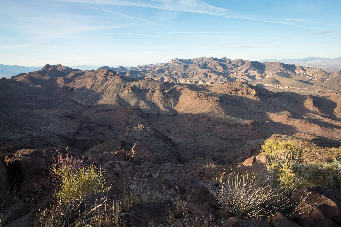
Feb 14, 2021 — From Oatman Highway, we followed a bad road on foot south until we reached some old ruins. The road is passable by high clearance and very good tires, but neither Whiley nor I were excited to drive the road. Once past the ruins, we continued south through the desert and entered a wash, following it until a moderate slope led us up the northern slope that would ultimately lead to Peak 4020. The first 3/4 of the ascent was mostly just typical desert terrain, but we soon reached a Class 3 move to get over a small cliff band. You can likely keep this Class 2 with some poking around. Above this cliff band, we neared the base of Peak 4020's sheer summit. There was a steep gully that brought us to its summit (Class 2+), lots of loose rock making it a bit thoughtful so we didn't knock each other out.
We worked our way down Peak 4020's southwest side on steep Class 2 terrain, encountering a Class 2+ move to get down. It was loose, but not nearly as bad as the ascent. We headed along the wide ridgeline on our way to Black Mesa's gradual ascent. Class 2 brought us just left of the rocky ridge crest and to the mesatop. A long and pretty stroll led us to the high point on the northwestern side of the mesa. We continued north off Black Mesa's summit and followed the remains of a mining trail, now used extensively by burros. Honestly the road isn't as helpful as we'd hoped it would be, since it was pretty eroded and easily lost. Regardless, we stuck the trail for as long as we could before hiking cross-country to an old road to the north and following this back to the car. The burros were particularly rambunctious, snorting at us from hundreds of feet away as a warning to keep clear.
Please consider helping me out if you find my site useful. I'm not sponsored, so all site fees are out-of-pocket and my time preparing these trip reports is unpaid. You can also hire me as a web developer. I really appreciate it!


If you find my site helpful, please help me replace my many broken cameras, fund my website fees (hosting, APIs, security), or just support my countless hours of work. I pay for all expenses myself, and all trip reports I post are unpaid and unsponsored, so any support is really appreciated!
If using PayPal, please select their option for "Sending to a friend" so they don't take out fees, thank you.
My site is free to use, but consider sending me a few bucks to help keep it running. Thanks in advance!