I provide a free route map, but you can also download a hike/drive GPX to assist you and to help support my site. Before sharing my GPX tracks with others, please remember my site is a free resource and I'm charging nominal fees to offset my substantial costs.
GPX track added to your cart.
Oct 07, 2020 — Cherry Creek Benchmark is an obsure and fairly big mountain in central Nevada, located off NV-93. My mid-clearance had no difficulty making it to my start point, and I suspect even less burly vehicles than mine could have made it with maybe some decent tires. The road continues a little farther, but a massive boulder blocks vehicle travel, and the road peters out shortly after anyway. I started hiking along the road to a point where I couldn't easily stay on the road due to lots of overgrowth, dropping to my right into the mouth of Exchequer Canyon where hiking was far less tedious. I continued up Exchequer Canyon, dodging the occasional tree and brush, but by no means did this feel like a bushwhack.
I came across a set of mining ruins just outside of the drainage, followed by another a few hundred feet up. The second set was nestled next to a limestone cliff that marked the entrance to a nice narrow section of canyon. I continued through the canyon, some minor Class 2 along the way. The canyon ws short-lived, but a nice shift from the gully that otherwise comprises the majority of this hike. I passed a junction in the drainage, keeping right. I eventually passed Exchequer Spring, which is just a trickle of water with some mosses and grasses. The drainage started becoming more steep past the spring and initially it was just a nice forest walk. Later, the drainage became littered with deadfall, easily avoidable by keeping just out of the drainage. The ascent got even steeper as I neared the head of Exchequer Canyon, but it's not an unpleasant experience.
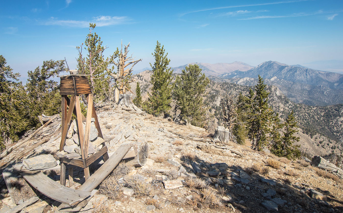
Once out of the drainage and on the ridge I headed to the right and soon reached the summit, which has nice views of the surrounding obscure NV peaks and an old survey marker that's still standing.
Please consider helping me out if you find my site useful. I'm not sponsored, so all site fees are out-of-pocket and my time preparing these trip reports is unpaid. You can also hire me as a web developer. I really appreciate it!


If you find my site helpful, please help me replace my many broken cameras, fund my website fees (hosting, APIs, security), or just support my countless hours of work. I pay for all expenses myself, and all trip reports I post are unpaid and unsponsored, so any support is really appreciated!
If using PayPal, please select their option for "Sending to a friend" so they don't take out fees, thank you.
My site is free to use, but consider sending me a few bucks to help keep it running. Thanks in advance!