I provide a free route map, but you can also download a hike/drive GPX to assist you and to help support my site. Before sharing my GPX tracks with others, please remember my site is a free resource and I'm charging nominal fees to offset my substantial costs.
GPX track added to your cart.
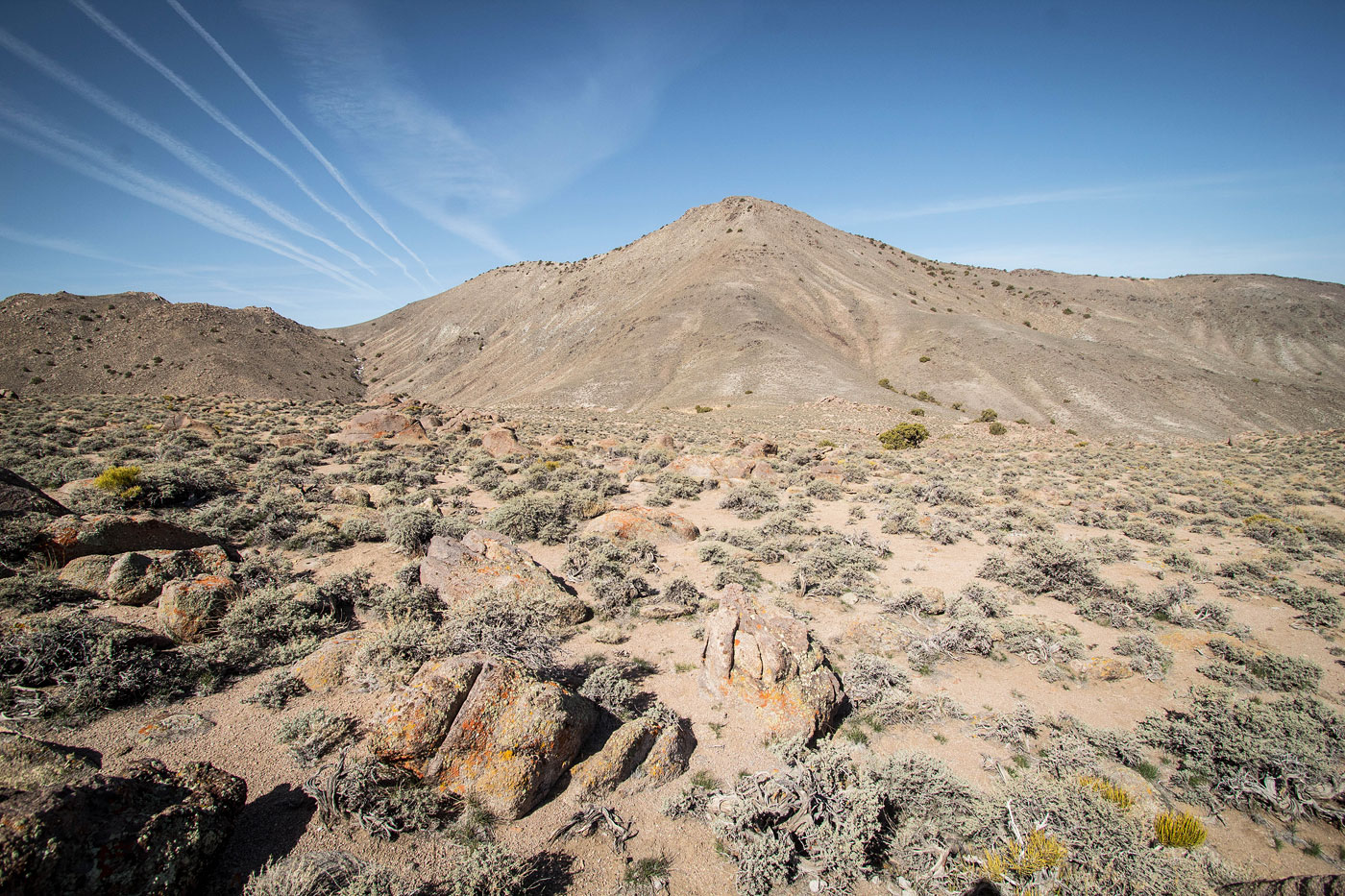
Apr 07, 2022 — The Garfield Hills are a remote and not particularly interesting small cluster of lumps outside of Luning NV. The high point, Garfield Hills High Point, has enough prominence to attract prominence-driven peakbaggers, but I can't imagine it gets much traffic otherwise. It seems most come from Power Line Road from the south via Bataan Mine, but I wasn't sure I could make it close enough to the peak in my car based on the reports of the bad road. Instead, I tried a new route by coming in from the north, taking the northern end of what is labeled as Power Line Road, which I'd later learn does not actually meet the southern Power Line Road approach, despite labeled as a road on maps. Coming this way would also enable me to hike to another peak to the east of the high point, Luning Benchmark, in order to form a pleasant loop.
To reach where I started, head southwest off NV-95 here (38.51296, -118.19312) and pass a fenced-in power contraption, following what's labeled as Power Line Road as it leads generally west along here (38.51142, -118.19651). The road continues without other junctions and is in great shape except for the last quarter mile where it enters a wash, and then ultimately became too washed out for my comfort. This wasn't a problem though, since my plotted loop would end me roughly where I parked anyway. An abandoned bus, car, and rough-looking building with the words "black hole circa 2012" graffiti'd on its outside gave me pause as to whether I would want to leave my car here or not. It felt pretty ominous, and closer inspection led me to believe this dwelling may have been occupied, though not recently.
I started along "Power Line Road", which headed southwest toward a canyon on the north side of the range high point. The road led to a water containment unit for wildlife and then I continued to the mouth of the canyon. Despite maps reading "Jeep Trail", this was no trail. The road very clearly ended abruptly in the wash and significant Class 2 obstacles aren't passable by anything motorized. I continued on, sort of happy I wouldn't be walking on doubletrack, and ascended the canyon until it became slightly more brushy. Realizing I had no reason to stay in this canyon since there was no road making travel easier, I decided to head up the slope to the south. A short section of steepness at the base of the slope to get out of the drainage led to slightly less steep hiking on easy terrain. This slope led me to the west ridge of Garfield Hills High Point.
Now along the ridgeline, the views were quite nice and the ridgeline consisted of mostly deserty tundra walking. A dip in the ridgeline added some extra vertical elevation gain. Once I took in the views from the summit, I scoped a route down to the east. I could see Luning Benchmark a bit over a mile away. This peak is also labeled "Black Dyke Mountain", but the incorrect spelling of "dike" makes this a pretty not okay combination of words, so Luning Benchmark it is for me. I started down Garfield Hills High Point on a short bit of loose Class 2, followed by more pleasant terrain. Toward the bottom of this east slope I was greeted by a small granitic boulder garden. Fortunately the boulders are spread sparsely enough that no tedious boulder-hopping is required. Another short section of Class 2 got me down to the saddle separating the high point from Luning Benchmark.
A dirt road heads north from the saddle and eventually back to my car, but first I wanted to get the second peak. From the saddle I headed east on easy terrain to attain the summit, some light Class 2 talus along the last few hundred feet. This peak wasn't particularly memorable so I didn't linger, making my way down its northwestern ridge and to the dirt road below. Following this road was easy, but it's barely a road. It mostly follows a wash and ultimately leads back to where I started, completing the loop. I think this loop made this otherwise somewhat boring area more interesting, and the boulder field garden on the east side of the high point was probably the highlight of the hike.
Please consider helping me out if you find my site useful. I'm not sponsored, so all site fees are out-of-pocket and my time preparing these trip reports is unpaid. You can also hire me as a web developer. I really appreciate it!


If you find my site helpful, please help me replace my many broken cameras, fund my website fees (hosting, APIs, security), or just support my countless hours of work. I pay for all expenses myself, and all trip reports I post are unpaid and unsponsored, so any support is really appreciated!
If using PayPal, please select their option for "Sending to a friend" so they don't take out fees, thank you.
My site is free to use, but consider sending me a few bucks to help keep it running. Thanks in advance!