I provide a free route map, but you can also download a hike/drive GPX to assist you and to help support my site. Before sharing my GPX tracks with others, please remember my site is a free resource and I'm charging nominal fees to offset my substantial costs.
GPX track added to your cart.
Aug 05, 2020 — My second big loop outside of Telluride, this incredibly scenic route hits a bunch of 13ers and visits some of the best scenery I've experienced in Colorado. Telluride's Bear Creek Trail is excrutiatingly popular, most visitors using it to head up to see Bear Creek Falls. I started early enough in the day that there were only a few trail runners because, you know, Colorado. I need to note that the Bear Creek Falls Trailhead is not a parking lot. In fact, there are "no parking" signs all over, and even if you wanted to pay for street parking, you can't because the maximum parking time is 3 hours in the city. After learning all of this the day before in preparation for this route, I knew to park at an all-day free summer parking lot and walk along the Telluride River Walk to access the Bear Creek Trailhead, hence the reason my map has me starting at the west side of Telluride.
Once on the Bear Creek Trail (a very wide road converted to trail), I followed this until a narrower trail diverted to the left. This trail would lead me along the Ballard Mountian Trail, which crosses over Bear Creek and right past a locally known water-carved grotto for years. It's considered a "secret", but I beg to differ. Even at 8am, there were people there. So I took a few shots and continued on. It's pretty, but a little underwhelming. I'll note that the Public Information Officer from Telluride reached out asking for me to remove the name of this spot because they are working to restore the area, so please do not post the name if you know it, and also respect the area.
From the pretty water-carved grotto, I continued along the Ballard Mountian Trail, which is a little difficult to keep track of before reaching the start of the many switchbacks due to more social trails than I expected to find. Hopefully in the coming months/years this trail will be more obvious, as it seems the town of Telluride is trying to restore the landscape and remove the many social trails. For now, my recommendation is to ensure you're always ascending and heading south. The trail will become clear once the switchbacks start, and will continue to be easy to follow until Ballard Mountain's summit. Along the way, it's fun to look down toward Telluride far below, and the many basins surrounding the peak are stunning. The last few hundred feet to the summit require some light Class 2 up an eroded gully. From Ballard Mountain, I continued south along the ridge toward Jackass Point, where the trail now basically disappeared. Though, a light social trail helps in guiding around some cliffs along Jackass Point's northern ridge, instead wrapping briefly to the right (west) and then reascending to the ridge and then the summit. The social trail continued lightly from Jackass Point and over to La Junta Peak, avoiding the ridge about haflway up to avoid some more cliffs.
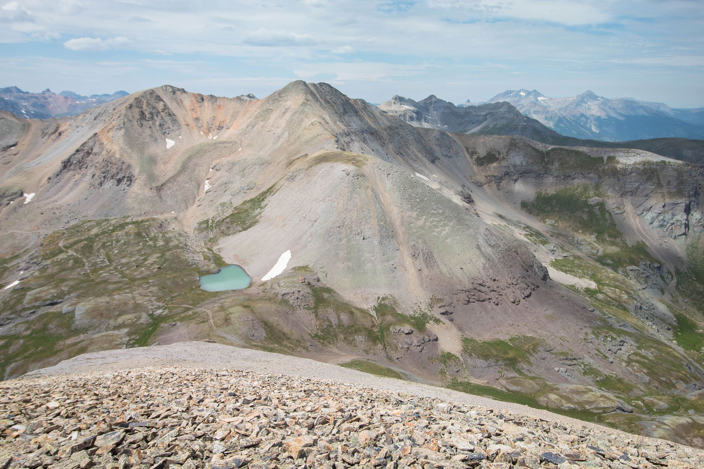
The views from La Junta Peak were absolutely beautiful, a more notable feature being a small lake near the saddle of La Junta Peak and Wasatch Peak. Across the basin to the east, I could see the peaks from my day before, including Three Needles and Bridal Peak, as well as trace my route with my finger, which was fun. The steep southern ridge leading to this saddle was mostly fine, but included one section of particularly steep scree. Once at the saddle, I entertained the idea of heading straight up Wasatch Mountain's scree-infested northern ridge, instead deciding to wrap to its east side past the pretty little lake and ascend using a mostly grassy slope instead. More amazing views up here, this time toward the bright orange colors of the peaks to come along my traverse. Initially, I thought I'd descend from Wasatch Mountain northern ridge, but the day was looking stormless and I was feeling very good, so I continued along the pleasant Class 2 ridge all the way to Oscar's Peak at the far southern end. The scrambling was minimal - mostly just slabs of talus that was relatively easy to walk on.
From Oscar's Peak, I debated heading back down its northern ridge to intersect the Wasatch Trail. This trail would lead me back along Bear Creek, making a very nice loop. However, I was feeling ambitious and continued west along the ridge to San Joaquin Ridge, another 13er. This traverse was yet another gorgeous stroll, where I only encountered a few Class 2 sections: one before the false summit of San Juaquin Ridge, a second just after it on steep, loose scree, and a third on the way up to the true summit. From the San Joaquin Ridge summit, I debated continuing along what research told me was a Class 2+ traverse over to Silver Mountain, but incoming clouds wouldn't permit it. Additionally, I likely would have been tempted to continue along the ridge and just take the free gondola down from Gold Ridge back to Telluride, but more research also enlightened me to the fact that that ridge is Class 5 and I would have made this lovely day into a sh*tshow.
That all being said, my plan would instead be to head down to the Wasatch Trail from San Joaquin Ridge and enjoy a pleasant hike back along a trail. From the summit, I scoped a minor cliff band below that required some foresight to avoid getting cliffed out before dropping down to the San Joaqin Ridge and its false summit's saddle. I then headed north on Class 2 terrain, trying to follow my scoped route. While there is likely more than one way down from the saddle, I stuck with what I remembered to play it safe. My route wanders a bit because I wanted to check out a small tarn along the way. I continued down a grassy gully which brought me on an animal trail down to the Wasatch Trail.
After a short time hiknig through grassy and wilflower-filled tundra, dying of excitement at the beauty despite the drizzle, I met up with a junction where the Wasatch Trail splits into two forks: main and east. I took the Wasatch Trail East Fork for no particular reason. Both would reunite in a mile or so down below. The trail continued to be gorgeous as it followed the East Fork of Bear Creek and then stayed high as the landscape fell away. A bunch of switchbacks led down into the main Bear Creek drainage and I continued along the Wasatch Trail until it met up with the Bear Creek Trail, where everyone in Telluride was hiking to Bear Creek Falls. I skipped the falls to avoid the crowds, but I'm sure it's pretty. Absolutely wonderful loop.
Please consider helping me out if you find my site useful. I'm not sponsored, so all site fees are out-of-pocket and my time preparing these trip reports is unpaid. You can also hire me as a web developer. I really appreciate it!


If you find my site helpful, please help me replace my many broken cameras, fund my website fees (hosting, APIs, security), or just support my countless hours of work. I pay for all expenses myself, and all trip reports I post are unpaid and unsponsored, so any support is really appreciated!
If using PayPal, please select their option for "Sending to a friend" so they don't take out fees, thank you.
My site is free to use, but consider sending me a few bucks to help keep it running. Thanks in advance!