I provide a free route map, but you can also download a hike/drive GPX to assist you and to help support my site. Before sharing my GPX tracks with others, please remember my site is a free resource and I'm charging nominal fees to offset my substantial costs.
GPX track added to your cart.
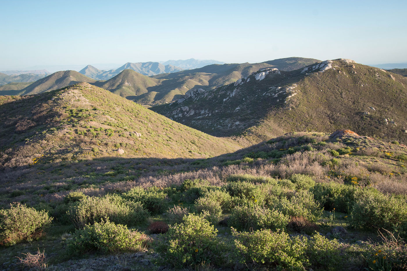
May 07, 2021 — Lost Peak is the high point of the Bull Valley Mountains. The road to reach it requires decent clearance. I parked at Lost Peak Spring and tried to locate an old trail that seems to be marked on some maps, but couldn't find it. Either cows or time seem to have removed any trace, so really there is no trail to the summit, but the bushwhacking to get there is overall not bad. I headed north toward Lost Peak's ridge, and there's really no one "best" way. I just kept choosing the path of least brush facilitated most of the time by animal trails to get up there. Once the terrain became more steep the brush seemed to fade a bit and once I was on the ridge crest the views made up for any minor bushwhacking. I hiked over a false summit and then ascended the steep last couple hundred feet to the true summit.
I intended to return the way I came from Lost Peak, but Peak 7324 to the southwest looked so majestic in the sunset lighting with its granite rock outcrop summit, that I couldn't justify not hiking over to it. I'm really glad I did, but it could be just because I was in a good mood. The ridgeline between Lost Peak and Peak 7324 begins mellow and gorgeous, with excellent views in all directions. On the northeast side of Peak 7324 is a dip in the ridgeline, the least pleasant part of the hike. A steep and loose descent through pretty waist-high bad brush led into the dip, where I briefly questioned my decision to hike this peak. The ridgeline leading directly to the summit from the dip seemed to look worse, so instead of tearing my skin apart I avoided the direct ridgeline and kept just left where the slope was a lot more clear of brush. A few hundred feet of steep hiking led to a small granite slickrock section and ultimately to the summit (Class 2). From the summit of Peak 7324, I headed generally east and was nervous I'd be dealing with a ton of brush, but after clearing the summit area I was awarded with grassy and pleasant terrain as I descended my slope of choice, which hugged the base of granitic features as I descended. An animal trail helped at the very end of this descent when the brush returned, bringing me safely to the forest road below. I followed the road back to my car.
Please consider helping me out if you find my site useful. I'm not sponsored, so all site fees are out-of-pocket and my time preparing these trip reports is unpaid. You can also hire me as a web developer. I really appreciate it!


If you find my site helpful, please help me replace my many broken cameras, fund my website fees (hosting, APIs, security), or just support my countless hours of work. I pay for all expenses myself, and all trip reports I post are unpaid and unsponsored, so any support is really appreciated!
If using PayPal, please select their option for "Sending to a friend" so they don't take out fees, thank you.
My site is free to use, but consider sending me a few bucks to help keep it running. Thanks in advance!