I provide a free route map, but you can also download a hike/drive GPX to assist you and to help support my site. Before sharing my GPX tracks with others, please remember my site is a free resource and I'm charging nominal fees to offset my substantial costs.
GPX track added to your cart.
Oct 24, 2019 — It's important to note that I rated this canyon as an ascent route because that's how we approached it. Most would likely rather descend this canyon using gear (technical rating 3A, longest rappel 30 feet). Doing this route as a descent route would definitely be a lot of fun as well, but I would highly recommend doing it as an up-climb. It's rare you can do an entire canyon bottom up without being faced with severe and usually unclimbable dryfall cliff-outs. For those who decide to rappel the canyon, it's a really pretty canyon and serves as a short and sweet descent just off the highway, but it's certainly less difficult as a descent. I rated this route Class 5 not for the exposure or risk factor associated with falling, but because the moves are difficult.
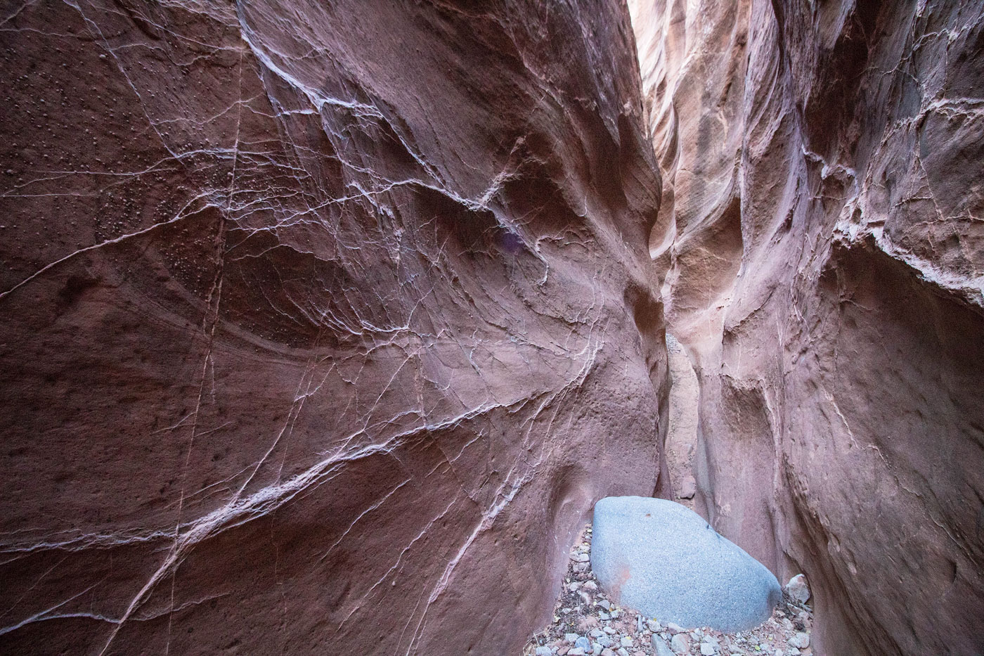
Matt and I saw this slot off the side of the road and decided to explore. We later found out this canyon is named Middle Fork of Maidenwater Canyon. We dropped off the highway down an eroded slope and entered the canyon, where we noted a human-made tunnel that re-routed the water under the highway. We encountered a few minor obstacles for the first bit of the canyon, but then got to some real stemming moves. We spotted webbing at the top of each climb, and I'd recommend bringing at least some webbing in case you decide to bail and want an easier way back down. The dryfall obstacles progressively got more and more difficult, and took all sorts of interesting movements to ascend. The final dryfall (or, the first dryfall if you're descending) was particularly interesting, involving scrambling up about 15 feet under a boulder, climbing out the front of it, and squirming up over the lip. Pics below will likely give better context of what to expect. What a blast.
The canyon appeared to narrow up again a little farther up, but we were looking for an escape as the sun was setting, and took the first one we could find to get up onto the ridge just south of Middle Fork of Maidenwater Canyon. Explore up farther if you have time. We headed south on pretty easy terrain, working our way to a sloping ridge to the south. We followed animal/social trails east back to the car.
Please consider helping me out if you find my site useful. I'm not sponsored, so all site fees are out-of-pocket and my time preparing these trip reports is unpaid. You can also hire me as a web developer. I really appreciate it!


If you find my site helpful, please help me replace my many broken cameras, fund my website fees (hosting, APIs, security), or just support my countless hours of work. I pay for all expenses myself, and all trip reports I post are unpaid and unsponsored, so any support is really appreciated!
If using PayPal, please select their option for "Sending to a friend" so they don't take out fees, thank you.
My site is free to use, but consider sending me a few bucks to help keep it running. Thanks in advance!