I provide a free route map, but you can also download a hike/drive GPX to assist you and to help support my site. Before sharing my GPX tracks with others, please remember my site is a free resource and I'm charging nominal fees to offset my substantial costs.
GPX track added to your cart.
Jul 25, 2020 — Amargosa Overlook is a nice point in the Spring Mountains that overlooks the Amargosa Valley. The route we took was pretty steep, but overall pleasant. I included an easier and less steep, though longer, alternative on the map, but this is not reflected in the stats I wrote up in this trip report. Using the longer (purple line) would add 2 miles each way. I recommend going this alternative route if you plan to trail run or would rather have a pleasant hike, opposed to a steep workout. We descended using the purple line and there aren't any pictures for that section of the route in this trip report.
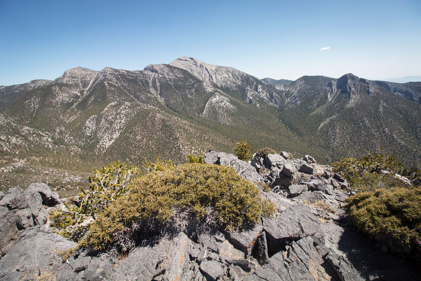
From the Lee Canyon trailhead, Austin and I used the very popular Bristlecone Trail until the first major bend, where the official trail headed north. Our route would continue west. Someone placed some logs at the start of our route to prevent confusion for those trying to follow the Bristlecone Trail, but we ignored the logs and headed up the very obvious social trail. This led through the forest and up a shallow gully, gaining a fair amount of vertical gain in a short time. We made it to a minor saddle, and then the social trail continued west, even more steeply for a couple hundred feet. Finally, the trail mellowed out and undulated along a nice ridge with occasional views toward McFarland Peak, Mummy Mountian, The Sisters, and others. The route was easy to follow for the most part: either stick to the rim, or follow the social trail which is obvious for most of the way. The view at the high point of the Amargosa Overlook toward Charleston Peak were really nice.
We returned via the purple route on the attached map, but again, the stats reflected assumes you do the hike as an out and back using the orange line only.
Please consider helping me out if you find my site useful. I'm not sponsored, so all site fees are out-of-pocket and my time preparing these trip reports is unpaid. You can also hire me as a web developer. I really appreciate it!


If you find my site helpful, please help me replace my many broken cameras, fund my website fees (hosting, APIs, security), or just support my countless hours of work. I pay for all expenses myself, and all trip reports I post are unpaid and unsponsored, so any support is really appreciated!
If using PayPal, please select their option for "Sending to a friend" so they don't take out fees, thank you.
My site is free to use, but consider sending me a few bucks to help keep it running. Thanks in advance!