I provide a free route map, but you can also download a hike/drive GPX to assist you and to help support my site. Before sharing my GPX tracks with others, please remember my site is a free resource and I'm charging nominal fees to offset my substantial costs.
GPX track added to your cart.
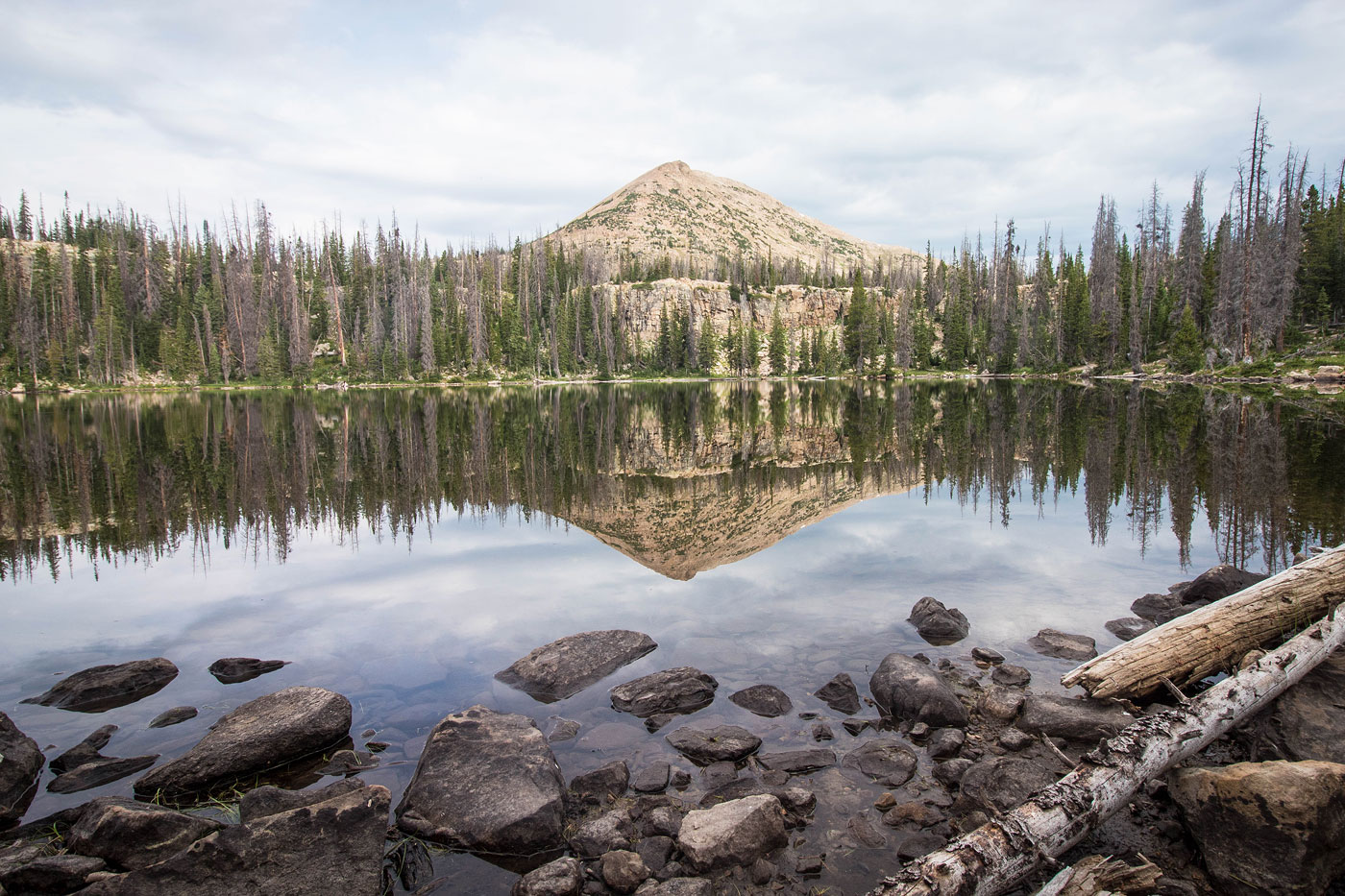
Jul 22, 2020 — This hike showed us that the west side of the Uintas is very different from the east. Our hike to Mount Watson and Notch Mountain was enough to get me excited for the Uintas' eastern peaks, where more lakes and less expansive peaks meant we had more fun and less slog to look forward to (*cough* Kings Peak *cough*). Starting from the absurdly popular Crystal Lake Trailhead, Matt and I headed along the well-marked trail, passing multiple lakes along the way. Cliff Lake was of particular interest, and we took a bunch of wildflower photos with Mount Watson in the background, the somewhat overcast day giving us decent lighting. Shortly after Cliff Lake and its constructed boardwalks along the trail, we ascended a steeper section of trail and made it to the south side of Watson Lake. While the trail continued along the right side of the lake, we headed around to its west side. We passed a couple of campsites and began ascending the southeast ridge of Mount Watson. Initially, we encountered some minor bushwhacking, but soon we had no issue as we left the treeline behind and started ascending Class 2 boulders. There's deifnitely no one correct way up Mount Watson. We stumbled onto a couple of Class 3 sections, but I'm sure that with careful route-finding, you could keep the ascent Class 2/2+. Regardless, we found the scramble to be pretty enjoyable, made nicer from the incresingly gorgeous views.
The summit of Mount Watson was much more incredible than we could have hoped, the shimmering lakes and bright green trees below getting us psyched for more. We noted Notch Mountain to the northwest, named for a feature called "The Notch", which separates the east and west peaks. We would only be going to the eastern peak today, the high point of Notch Mountain. We headed down the northern slope of Mount Watson, keeping to the ridge until seemed to be getting too rugged. At this point, and I can't say where the ideal spot would be (ours was fine), we dropped off a steep slope toward Clyde Lake below, our route taking us to the north side of Clyde Lake. A sort-of land bridge led us between a bunch of minor lakes as we headed up to The Notch. Just below The Notch, a social trail led along a pretty bench and avoided the cliffs and trees above North Twin Lake.
Once at The Notch, we ascended the west ridge of Notch Mountain, an unexpected, fun Class 3 move preventing easy access. Once above the scramble, we stayed low, though we were tempted to keep higher. Lower meant fewer boulders, but whichever way you end up traversing to the summit, there will be plenty of Class 2 boulder-hopping. A few hundred feet from Notch Mountain's summit, we headed directly to the ridge to avoid trees and a social trail brought us up from there.
After coming down from Notch Mountain and making it to The Notch, we hopped onto the well-traveled Notch Mountain Trail leading south down from The Notch. This trail passed a junction (we went left, as right would have brought us back toward Clyde Lake), and back to the trailhead.
Please consider helping me out if you find my site useful. I'm not sponsored, so all site fees are out-of-pocket and my time preparing these trip reports is unpaid. You can also hire me as a web developer. I really appreciate it!


If you find my site helpful, please help me replace my many broken cameras, fund my website fees (hosting, APIs, security), or just support my countless hours of work. I pay for all expenses myself, and all trip reports I post are unpaid and unsponsored, so any support is really appreciated!
If using PayPal, please select their option for "Sending to a friend" so they don't take out fees, thank you.
My site is free to use, but consider sending me a few bucks to help keep it running. Thanks in advance!