I provide a free route map, but you can also download a hike/drive GPX to assist you and to help support my site. Before sharing my GPX tracks with others, please remember my site is a free resource and I'm charging nominal fees to offset my substantial costs.
GPX track added to your cart.
May 14, 2022 — Black Butte is a large hump in Dixie National Forest that attracts few visitors. When accessed, it's usually done as a near-drive-up via the good dirt roads leading to its base. I was hoping to get a nice hike out of the day, choosing to attempt the poorly-documented Big Hollow Trail, hoping it wasn't too overgrown to be fun. Fortunately it's in great shape! Although this isn't an epic hike by any means, it's likely you'll be alone for its duration, and the trail has lots of cool little highlights. Google was able to get me to the trailhead, but I recommend making one amendment. Big Hollow Road splits here (37.60155, -112.4225), but make sure to keep right at the fork since the left road is in bad shape. Aside from a couple of washouts along the road earlier on after leaving pavement, the entire road is in very good shape (high-clearance still required to get over these washouts). The last couple of miles starting here (37.5921, -112.40999) get a bit more rough. You could also drive an extra half mile or so to the official trailhead past where I parked, but I didn't like how narrow the road was becoming and was content to walk this section.
The trail begins by paralleling the Big Hollow drainage via a trail with the same name. It's in great shape and seems to be maintained somewhat regularly. I reached a junction with the Camp Eli Trail, which heads to the right. I took this trail, leaving the Big Hollow Trail and ascending next to a drainage. The trail became more steep and had some eroded sections, but was still very good and easy to follow. After gaining about 600 feet of vertical from the junction, the trail mellowed out and entered a forested area, passed a trough, and then crested a ridge where it intersected with the Grand View Trail. It might take a second to locate the Grand View Trail, which leads directly east up the ridge crest. If you start descending, you've gone too far.
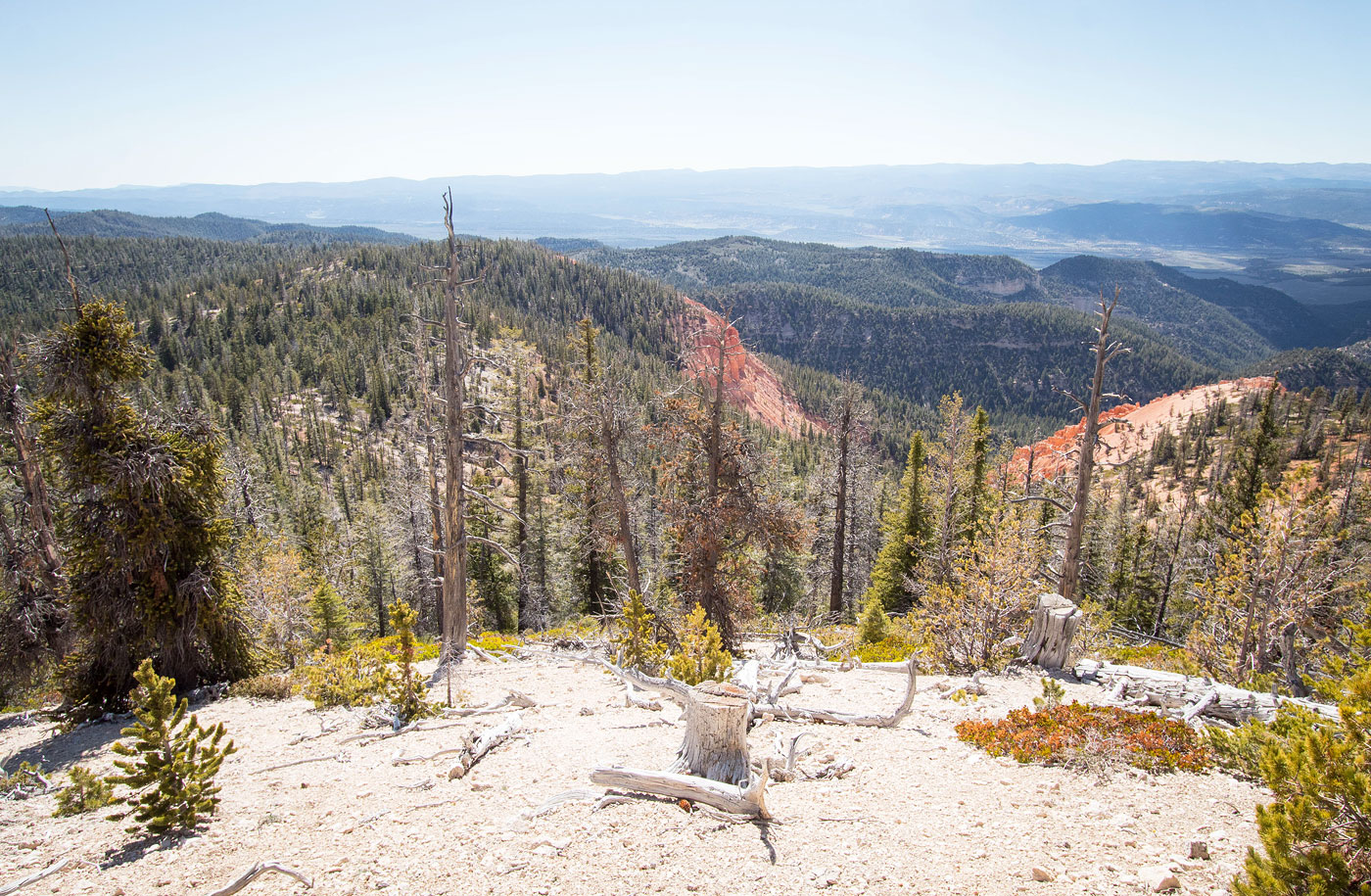
Once I was on the Grand View Trail, I continued to have no issues with following the route. Orange and white eroded hoodoos became visible along the clff bands to the north, a more subtle version of nearby Cedar Breaks National Monument. The views become more expansive as I ascended to Forest Road #106 above. FR 106 was only a short segment of the hike, since the Grand View Trail veered off and followed the ridge crest, while the road continued skirting around the south side. Unfortunately the Grand View Trail continued as a narrow double-track, but the views were nice enough that I didn't mind much. More pretty hoodoos appeared to the north and soon I was just below Black Butte's summit, though a couple hundred feet below and to the west.
The Grand View Trail doesn't lead to the summit, nor does any road or trail. Instead, I left the Grand View Trail and ascended through the forest on steep terrain (some might say Class 2, but it's just a short, steep section). A few hundred feet of easy bushwhacking got me to the high point, but the views were all obscured by trees. I returned the same way I came up.
Please consider helping me out if you find my site useful. I'm not sponsored, so all site fees are out-of-pocket and my time preparing these trip reports is unpaid. You can also hire me as a web developer. I really appreciate it!


If you find my site helpful, please help me replace my many broken cameras, fund my website fees (hosting, APIs, security), or just support my countless hours of work. I pay for all expenses myself, and all trip reports I post are unpaid and unsponsored, so any support is really appreciated!
If using PayPal, please select their option for "Sending to a friend" so they don't take out fees, thank you.
My site is free to use, but consider sending me a few bucks to help keep it running. Thanks in advance!