I provide a free route map, but you can also download a hike/drive GPX to assist you and to help support my site. Before sharing my GPX tracks with others, please remember my site is a free resource and I'm charging nominal fees to offset my substantial costs.
GPX track added to your cart.
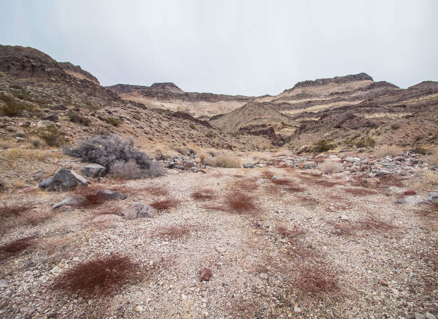
Feb 09, 2020 — Brown Peak looks pretty boring from all angles while driving past it, but my perception of the peak changed completely once we were working up its west face. It's very colorful, despite how it might appear in the photos below due to poor overcast lighting. I should note that there are two routes up the peak: this one coming from the west, which requires a bit of driving on a dirt road in good shape, but reduces the amount of walking time through flat desert; or the eastern approach, which has easier car access and I haven't done, but honestly doesn't seem as interesting of a route. To access the trailhead, turn off at here (36.2099079, -116.3893925) from the main paved road. Any car can likely make it.
From a small pull-out, we slogged through the gully-rutted desert, our first milestone being a gap to the right of a dark lump ahead, where we ascended to a low saddle and got a nice view of the whole route to come. Brown Peak was looking pretty nice perched on top of yellow cliff bands. We dropped east off the low saddle and side-hilled down into the major wash below. After only a couple hundred feet of wash walking as we headed east, we noted the wash led to a dryfall. Instead, we left the wash and headed up a slope that would bypass the drainage completely, leading us instead steeply up and around the east side of a small and cliffy peak (Class 2). We found ourselves at a small saddle northwest of Brown Peak. The views south were really stunning, the colorful cliff bands coming down from the ridgeline above unique.
We continued generally east along the ridge, picking our way around Class 2 obstacles, but mostly just sticking to the high point of the slope. A few hundred feet from the summit, we encountered some steep and loose scrambling (Class 2+) that got us up the dark cliffs surrounding Brown Peak. A short walk on the mostly flat summit of Brown Peak led to the high point.
Please consider helping me out if you find my site useful. I'm not sponsored, so all site fees are out-of-pocket and my time preparing these trip reports is unpaid. You can also hire me as a web developer. I really appreciate it!


If you find my site helpful, please help me replace my many broken cameras, fund my website fees (hosting, APIs, security), or just support my countless hours of work. I pay for all expenses myself, and all trip reports I post are unpaid and unsponsored, so any support is really appreciated!
If using PayPal, please select their option for "Sending to a friend" so they don't take out fees, thank you.
My site is free to use, but consider sending me a few bucks to help keep it running. Thanks in advance!