

Starting from the official Crag Crest Trailhead.
The trail leads through some meadows.
Looking back, already lakes visible.
The junction that I'll rejoin later after completing the loop. I headed left first, which would lead to the ridge.
The trail leads safely through a boulder field.
Wolverine Lake on the right as the trail ascends.
Along the ridge.
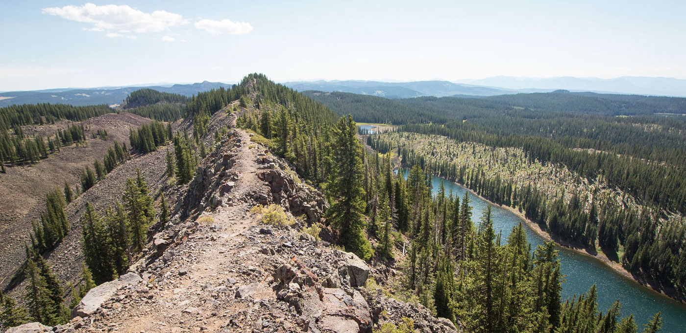
View north along Crag Crest toward Cottonwood Lakes.
The famous volcanic ridgeline Crag Crest is known for.
Looking back as I start along the ridge.
The trail continues through the forest for a short time before reemerging onto the narrow ridge.
Butts Lake visible on the right.
Looking back at the many lakes visible along the Crag Crest Trail.
Butts Lake on the right.
View back the way I came.
The trail descends eventually, Bullfinch Reservoir visible below.
At the west side of Upper Eggleston Lake.
The trail continues through the forest.
Eggleston Lake visible below.
Unfortunate aftermath of logging.
The trail meanders around hills, through forest and deforested areas.
Hotel Twin Lake below.
The last stretch continues through a pretty meadow.
Looking back through the meadow.
A junction that leads back to the start of the loop.
Hire me or show me some love!
Hire/refer me as a web developer or send me a few bucks if you find my site useful. I’m not sponsored, so all fees are out-of-pocket and my time preparing trip reports is unpaid. I really appreciate it!