stav is lost logo
  • Find Hikes
    • Most recent
    • Trip Report Index
    • Hikes by Region
    • Search Hikes
  • Map
  • About
  • Love
Hike Dorset Mountain in Green Mountain National Forest, Vermont - Stav is Lost

Hike Dorset Mountain Green Mountain National Forest, VT

Class 1 6.8 miles 2400 gain 3-5 hrs Out and Back
Effort
Beauty
Personality
Solitude
DirectionsRoute MapDownload GPX

Dorset Mountain GPX Track

I will always provide a free route map, but you can also download a hike/drive GPX to assist you and to help support my site. Before sharing my GPX tracks with others, please remember my site is a free resource and I'm charging nominal fees to offset my substantial costs.

GPX track added to your cart.

Add to Cart ($2.50)
View Cart

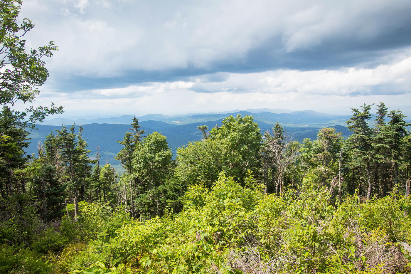
Jul 22, 2021 — I parked at a pull-out at what I believe is the trailhead for Dorset Mountain. I don't think it's legal to drive farther up the road, but I'm not sure. I continued on foot, the first mile or so really easy road walking. Then the road started to deteriorate and became progressively more steep after crossing a creek. The road continued up to the saddle on Dorset Mountain's west side. From here, I turned right and headed up more steep road to the saddl eof Dorset Mountain's east and west summits. The west summit has the remains of a fire tower and a somewhat nice view, while the east summit is the high point and has no views, but some nice lush greenery.

PEAKS ON HIKE
Elevation (ft) / Prominence (ft)
Peaks on hike
Elevation
Prominence
1
Dorset Mountain
3760 ft
2820 rise

Show me some love

Please consider helping me out if you find my site useful. I'm not sponsored, so all site fees are out-of-pocket and my time preparing these trip reports is unpaid. You can also hire me as a web developer. I really appreciate it!

Thank you

Next HikePrev Hike
  • Next Hike
  • More Near Here
  • Prev Hike
photo protector Hiking along the road.
Hiking along the road.
photo protector The road parallels a creek.
The road parallels a creek.
photo protector A creek crossing. Past here the road begins to get progressively more steep.
A creek crossing. Past here the road begins to get progressively more steep.
photo protector Ascending along the road.
Ascending along the road.
photo protector No caption.
photo protector View back down the road as I progress to the saddle above.
View back down the road as I progress to the saddle above.
photo protector No caption.
photo protector The road deteriorates almost completely before reaching the saddle.
The road deteriorates almost completely before reaching the saddle.
photo protector Just below Dorset Mountain's western saddle looking back.
Just below Dorset Mountain's western saddle looking back.
photo protector At the saddle. Stay right.
At the saddle. Stay right.
photo protector Keep right, still ascending.
Keep right, still ascending.
photo protector View back as I ascend to the saddle of the east and west summits.
View back as I ascend to the saddle of the east and west summits.
photo protector No caption.
photo protector Just before the trail junction separating the east/west summits of Dorset Mountain.
Just before the trail junction separating the east/west summits of Dorset Mountain.
photo protector Continuing on the flooded trail to the high point.
Continuing on the flooded trail to the high point.
photo protector Lush greenery on the way to Dorset Mountain's high point.
Lush greenery on the way to Dorset Mountain's high point.
photo protector Dorset Mountain. No views.
Dorset Mountain. No views.
photo protector Back at the saddle/junction of the east/west summits. Onward to the fire tower remains.
Back at the saddle/junction of the east/west summits. Onward to the fire tower remains.
photo protector Dorset Mountain fire tower.
Dorset Mountain fire tower.
photo protector No caption.
photo protector Dorset Mountain fire tower view.
Dorset Mountain fire tower view.

Show Me Some Love

If you find my site helpful, please help me replace my many broken cameras, fund my website fees (hosting, APIs, security), or just support my countless hours of work. I pay for all expenses myself, and all trip reports I post are unpaid and unsponsored, so any support is really appreciated!

If using PayPal, please select their option for "Sending to a friend" so they don't take out fees, thank you.

PayPalVenmoCash App

About  Contact  Love

© 2023 Stavros Basis.

DISCLAIMER: All activities you find on this site are dangerous. I am not responsible for anything you do in the outdoors. Please practice good ethics, and don't take any risks that put yourself or others in danger.


Thanks for visiting!

My site is free to use, but consider sending me a few bucks to help keep it running. Thanks in advance!

Sure!Nope.