I provide a free route map, but you can also download a hike/drive GPX to assist you and to help support my site. Before sharing my GPX tracks with others, please remember my site is a free resource and I'm charging nominal fees to offset my substantial costs.
GPX track added to your cart.
Jan 27, 2022 — Duncan Benchmark is a high-prominence point along the brushy ridgeline labeled Grand Wash Cliffs. It's also the high point of the Music Mountains, but I heard none unless you call my singing in frustration "music". Previous parties mentioned coming in from the north from a landmark called "Ray's Place", which apparently has the potential for restrictions by a ranch owner and I wasn't really willing to risk the drive only to get shut down or be tempted to trespass. Instead I decided to try a route from the south via Tenny Ranch Road and Music Ranch Road. An added benefit of doing this would be that I could try to establish another route for this peak in case the northern one is no longer accessible. Plus apparently that northern road isn't great. Reaching my start point was mostly easy-going, aside from a couple of short spots along Tenny Ranch Road where mid-clearance would be required. Google navigated me to my start point just fine. On the way past the ranch, there is a register that requires a sign in upon entering, but I encountered no signage deterring access at all.
From my pull-off, I started north toward a ridgeline that seemed like it might lead nicely to the rim above. From below there seemed to be a couple of potential obstacles along this ridge, but ultimately nothing exceeded Class 2. Once along the ridge, a faint animal trail led much of the way. While it was certainly not necessarily easy to follow, it allowed for a certain sections of brush to be easily avoided. With the exception of a few annoying yucca that nabbed me, I was pretty pleased so far with the route. Along the way a small stand of granite pinnacles is easily avoidable on their right. Past here, some sections are a little steep and the ground is a little sandy, but it was a nice ascent to the rim. I was excited by how nicely this was going, but lol.
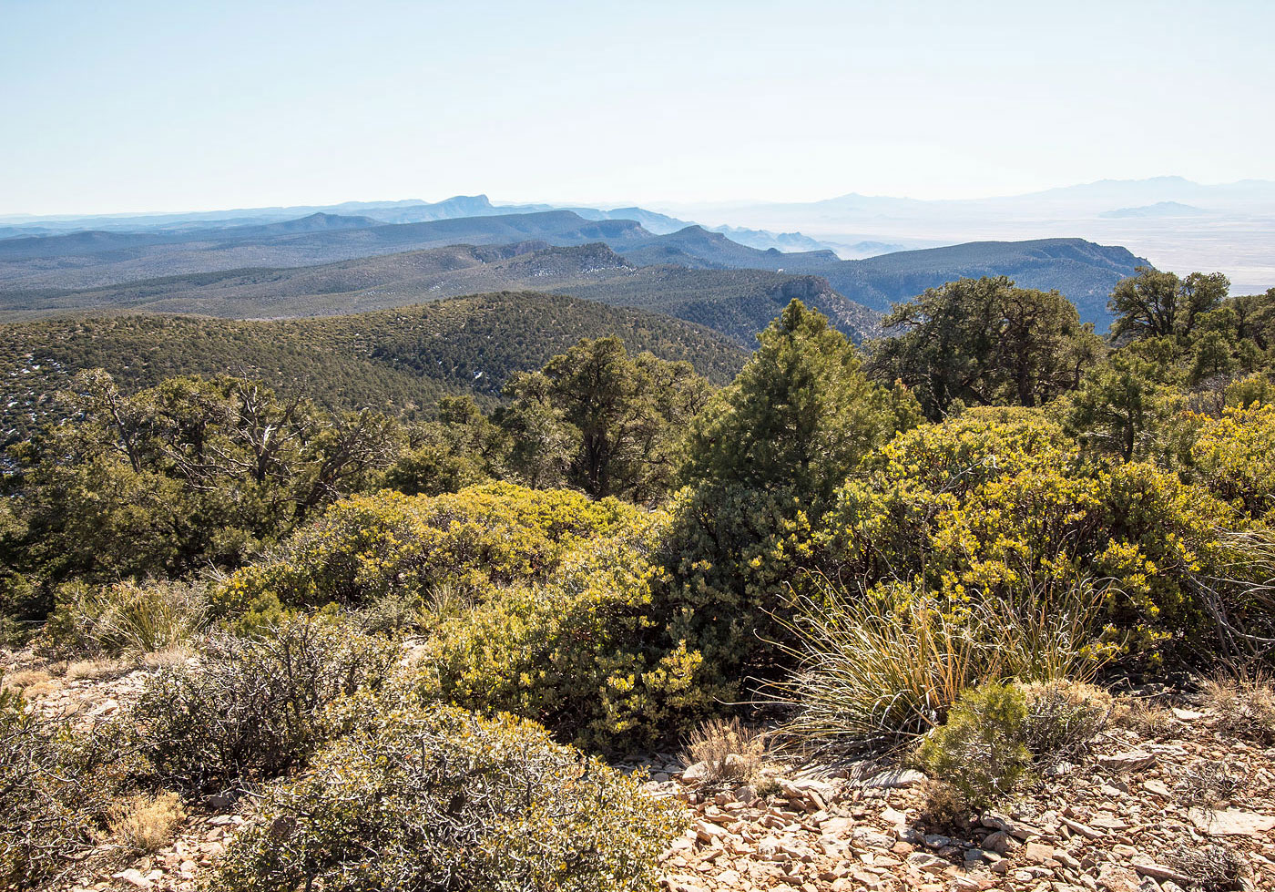
Once on the rim, I could see the summit well ahead. Duncan Benchmark was about two miles to the north. I noted on a topo map that there would be a couple of minor humps along the way to the summit, the slopes gradual enough that the elevation change wouldn't be all that noticeable. What I didn't realize was that the tree-dodging and full-on bushwhacking would slow me down to the point where I stopped enjoying the hike. It's the kind of 'shwhack where you are relieved to see 20 feet of clear ground ahead of you. I might be exaggerating a little, but there certainly were spots where I wasn't thrilled. Maybe pants and a jacket would have helped alleviate the somewhat aggressive occasional manzanitas and scrub oak. I'll note that on many occasions along the forever rim, I would be within the trees and their low-hanging brittle death limbs, but would notice ankle-high brush on the slopes to the right, so I would go over there instead. Once there, the trees became more appealing and so I'd work my way back over. I performed this zig-zag maneuver multiple times before deciding ducking under the tree cover was preferable to high-stepping over manzanitas. Choose your poison, I suppose.
Eventually I got to the summit, and the views from Duncan Benchmark were nice, but the landscape below is just uninspired desert. I tried to peer down the more standard route and it did seem to have less bushwhacking than my route, but only because the rim walk was shorter than my two miles. I don't ever intend to come back to this peak to attempt the northern route, so I can't say if it's better or worse. It looks like no matter how you try to get up here, there's some brush to contend with.
On my way back I decided to add Peak 6133 to the itinerary, a consolation prize for the additional mileage and unexpected brush. This peak ended up being quite nice, minimal brush to its summit and much more pleasant views from the top of its short southern cliff face. In fact, if this hike were only to bag this little guy, it would have been a relatively good one. I descended south from this peak to get down to the road more quickly, but this was a horrible idea and I didn't even include this route in my attached map. I recommend just returning to the ascent ridge.
Please consider helping me out if you find my site useful. I'm not sponsored, so all site fees are out-of-pocket and my time preparing these trip reports is unpaid. You can also hire me as a web developer. I really appreciate it!


If you find my site helpful, please help me replace my many broken cameras, fund my website fees (hosting, APIs, security), or just support my countless hours of work. I pay for all expenses myself, and all trip reports I post are unpaid and unsponsored, so any support is really appreciated!
If using PayPal, please select their option for "Sending to a friend" so they don't take out fees, thank you.
My site is free to use, but consider sending me a few bucks to help keep it running. Thanks in advance!