I provide a free route map, but you can also download a hike/drive GPX to assist you and to help support my site. Before sharing my GPX tracks with others, please remember my site is a free resource and I'm charging nominal fees to offset my substantial costs.
GPX track added to your cart.
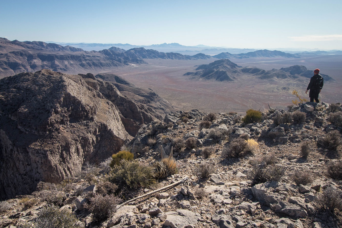
Jan 08, 2020 — Elbow Range High Point was a great first hike for 2020, the peak being on my radar since I first saw its stunning cliffs when I did the Arrow Canyon Range High Point. Austin and I parked on the side of Highway 93 and headed west through the desert, eventually entering a wash that led us northwest into a progressively narrowing canyon. Elbow Butte (which we'd do later) nestled us in to the northeast. We were confronted with two drainage choices to ascend to Elbow Range HP, and we chose the northern one to ascend. The topo map made the southern canyon appear pretty cliffy. Ultimately, our ascent route was more fun, but definitely more time-consuming. On our descent (blue line on the attached map), we figured we'd give the southern canyon a try even though there was a chance we'd get cliffed-out, but it went splendidly. There were a few dryfall obstacles, but overall it was much easier than the northern route.
Assuming you want to do the same route we took, we started up our northern drainage option, where we found some fun Class 2+ dryfall obstacles and were spit out onto the long northern ridge of Elbow Range High Point. A Class 3 bit led to a false summit, where a slightly scarier class 3 descent led down to a saddle just north of the peak. This is where the southern drainage option would have brought us had we chosen to ascend from there. From the junction of the two route options, we continued south along the Class 2 ridgeline to the summit. I was initially hoping to drop down from Elbow Range HP and continue to Fleur de Lis Peak to the southeast, but the cliffs were impassable, in my opinion.
We returned using the southern gully and ascended Elbow Butte, a short excursion that gave us some nice views of Elbow Range High Point. From the summit, we dropped down the south side, encountering a couple of short minor Class 3 cliff band sections before descending on easier terrain back through the desert and to the car.
Please consider helping me out if you find my site useful. I'm not sponsored, so all site fees are out-of-pocket and my time preparing these trip reports is unpaid. You can also hire me as a web developer. I really appreciate it!


If you find my site helpful, please help me replace my many broken cameras, fund my website fees (hosting, APIs, security), or just support my countless hours of work. I pay for all expenses myself, and all trip reports I post are unpaid and unsponsored, so any support is really appreciated!
If using PayPal, please select their option for "Sending to a friend" so they don't take out fees, thank you.
My site is free to use, but consider sending me a few bucks to help keep it running. Thanks in advance!