

Starting along the Colorado Trail.
Along the Colorado Trail.
After leaving the Colorado Trail, continuing through open grasses.
Looking back toward Little Molas Lake (left), and the grassy slope I ascended (right).
None of the peaks are visible yet, just some of the rocky ridges protecting the peaks from easy access. The route continues in the center of this photo, a weakness in the cliffs becoming apparent shortly.
I stumbled on an animal trail that helped guide me through part of the approach, but really it's just meadow pretty much the whole way and overall not difficult.
Looking back toward Little Molas Lake, North Twilight Peak visible on the right, Snowdon Peak center.
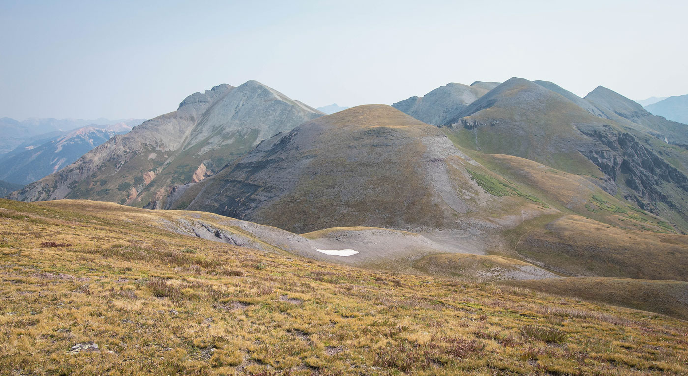
First view of the weakness in the cliffs, center. I recommend staying high, since there's a fair amount of brush as you approach the drainage ahead. West Turkshead Peak is visible top left.
After avoiding pretty much all of the brush, I finished the descent into the drainage. You can't see it in this photo, but there's a social trail on the opposite side (right) that leads to the weakness. I crossed the drainage and headed up to it.
On the opposite side of the drainage, headed toward the weakness of a decent trail.
Looking back along the social trail. My route came from those trees just right of center, across the drainage, and up to the trail.
Approaching the weakness, just barely Class 2.
Looking back again before the trail takes me away from the weakness.
Continuing on the trail, which heads right beneath the hill ahead. I wanted to go up to West Turkshead Peak first, taking the grassy slope on the left.
Looking back as I ascend the grassy slope to Turkshead Peak. The route from the cliff weakness came in on the right.
West Turkshead Peak, view south. Little Molas Lake visible on the left, North Twilight left of center, Engineer Mountain far right.
West Turkshead Peak, view north toward the peaks to come. The hill in the center is an unnamed point that the social trail completely avoids. Sultan Mountain is the big one on the left.
West Turkshead Peak, view west toward the Vermilion group and friends.
Back along the trail, avoiding an unnamed point and continuing to Spencer Peak.
Looking back.
The rocky section in the center of this photo has some minor Class 2 steepness. Spencer Peak top right.
Looking back.
View as I start ascending to Spender Peak toward Sultan Mountain (left).
View back as I ascend to Spencer Peak.
Spencer Peak, view toward Grand Turk (right of center), and Sultan Mountain (left).
Looking back toward Spencer Peak as I ascend to Grand Turk.
At the true summit of Grand Turk, Spencer Peak left and the false summit of Grand Turk on the right.
Continuing north from Grand Turk toward Sultan Mountain.
Mostly just easy talus walking, with one section of light Class 2 up Sultan Mountain.
Looking back toward Grand Turk (left) and Spencer Peak (right).
Sultan Mountain ahead.
Sultan Mountain summit, view back toward Grand Turk (left of center), Spencer (right of center), West Turkshead Peak (far right).
Sultan Mountain, view northeast toward Silverton, CO.
Hire me or show me some love!
Hire/refer me as a web developer or send me a few bucks if you find my site useful. I’m not sponsored, so all fees are out-of-pocket and my time preparing trip reports is unpaid. I really appreciate it!