I provide a free route map, but you can also download a hike/drive GPX to assist you and to help support my site. Before sharing my GPX tracks with others, please remember my site is a free resource and I'm charging nominal fees to offset my substantial costs.
GPX track added to your cart.
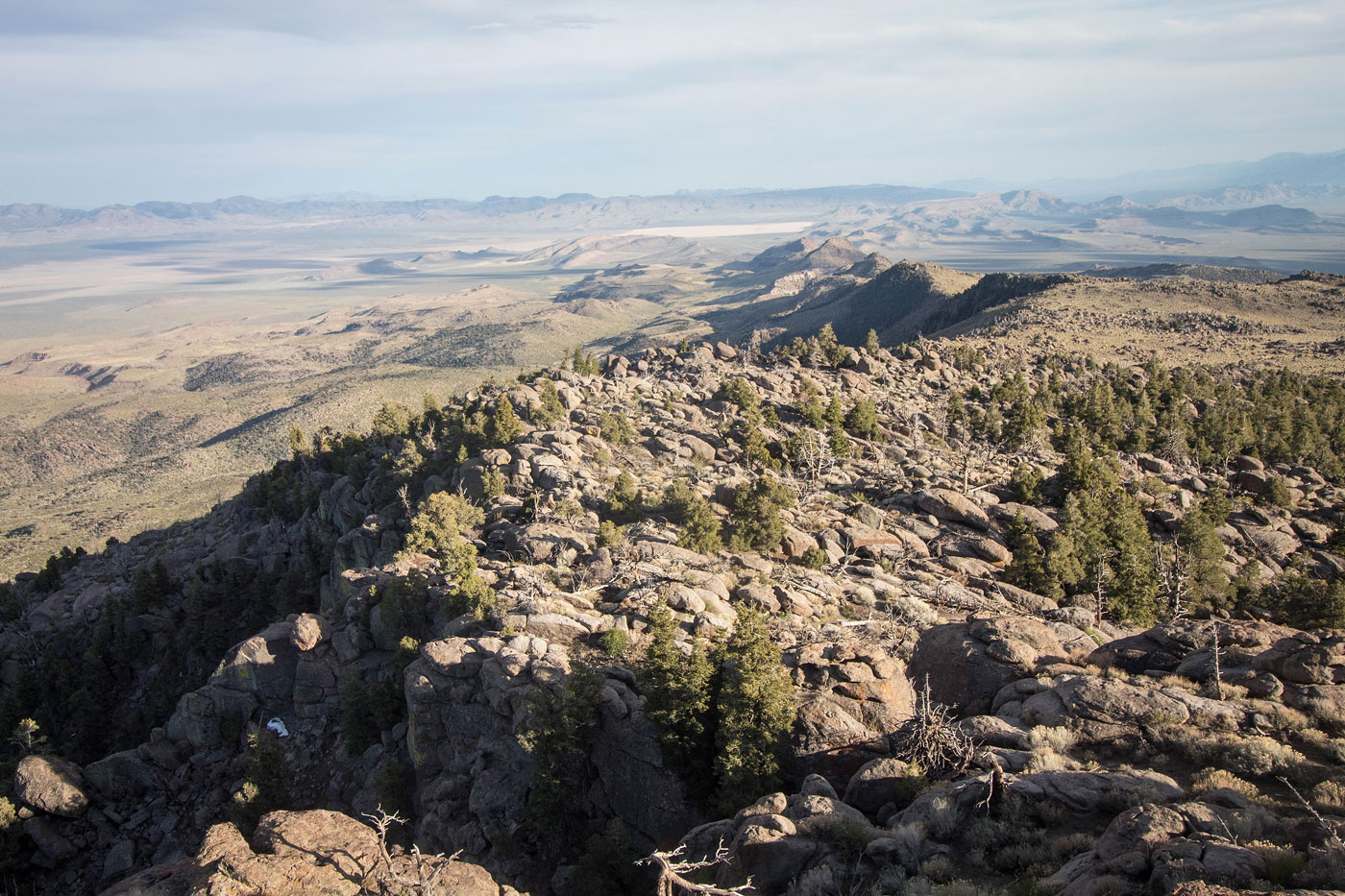
Apr 26, 2020 — Hyko Benchmark, the high point of the South Pahroc Range, was much more incredible than I thought it would be. A steep slope, rock garden, maze of sorts, and amazing sunset views kept me highly entertained.
The spot where I started is accessible by any vehicle, and better trucks could continue along the spur road for another half mile. I walked it since I'd already been giving my car a fair beating. The grassy slopes of Hyko Benchmark's east slopes were really gorgeous, round and pretty boulders poked out from all directions, and flowers added color to the route. I was already excited. I left the road at a point where the slope on my right became less of a nuisance and hiked steeply up a slopy ridge. Along the way, I encountered three sections of Class 2 route-finding on bouldery rock outcroppings. The majority of the vertical gain was in this short section, probably about 1500 feet in three quarters of a mile. It was grassy and overall pleasant, just a quad-buster.
I reached the ridgeline and immediately stopped in my tracks. The route ahead was riddled with gorgeous boulders and the high point sat majestically in the distance. I took a million photos on my way, just enjoying the natural rock garden-esque vibe of this section. The slope was mellow and enjoyable. Views in all directions had me shrieking with glee. The rocks began to get more dense and tall and the mellow rock garden became a somewhat complex boulder maze. It wasn't without brush, but bushwhacking was minimal. I made a few wrong turns, but had better luck later on my descent. I would recommend playing on the boulders, but you can definitely keep to Class 2 route-finding with some thoughtful planning. Soon the boulders became very concentrated as I neared the summit, and I avoided the majority of them by following a sparsely-cairned route up to the southern ridge of Hyko Benchmark. A couple of easy Class 3 moves led to the final summit block. I scoped the base and located what I thought was the most feasible Class 3 option to gain the summit. The views were stunning, and I took in the setting sun for a bit before returning through the maze.
Please consider helping me out if you find my site useful. I'm not sponsored, so all site fees are out-of-pocket and my time preparing these trip reports is unpaid. You can also hire me as a web developer. I really appreciate it!


If you find my site helpful, please help me replace my many broken cameras, fund my website fees (hosting, APIs, security), or just support my countless hours of work. I pay for all expenses myself, and all trip reports I post are unpaid and unsponsored, so any support is really appreciated!
If using PayPal, please select their option for "Sending to a friend" so they don't take out fees, thank you.
My site is free to use, but consider sending me a few bucks to help keep it running. Thanks in advance!