I provide a free route map, but you can also download a hike/drive GPX to assist you and to help support my site. Before sharing my GPX tracks with others, please remember my site is a free resource and I'm charging nominal fees to offset my substantial costs.
GPX track added to your cart.
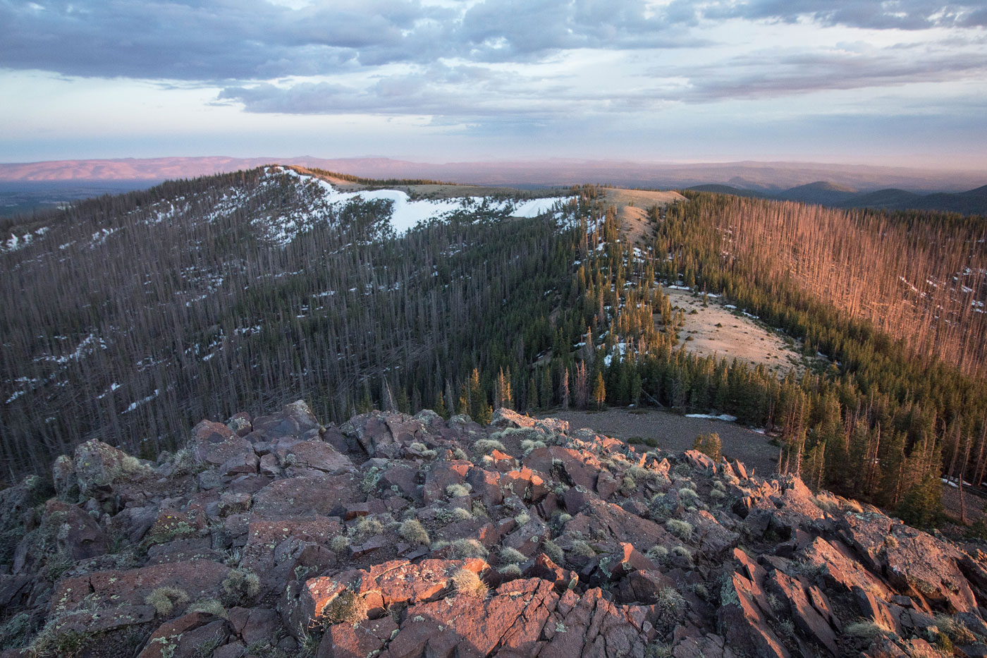
May 30, 2020 — Two trails lead to the near-summit of Mount Baldy, the high point of the White Mountains in eastern Arizona. I say near-summit because permission required from the White Mountain Apache Tribe to reach the summit, where the trails no longer lead and you can be fined for hiking without permission. The popular West Baldy Trail was more gorgeous than we could have hoped, and is the more often-used trail. The East Baldy Trail apparently is slightly overgrown, so we didn't risk it. The "west" and "east" refer to the forks of the Little Colorado River, not the cardinal direction relative to the mountain itself. Both trails start on the east side of Mount Baldy.
Lots of walking through alternating forest and meadows and paralleling the river had Matt and I feeling high in spirit. We had already hiked 11 miles today, so adding this 16+ could only be enjoyable if there were nice views, and there were. As we entered the eastern basin of Mount Baldy, some minor deadfall impeded quick hiking, but overall the trail was in really amazing shape and we made great time. The West Baldy Trail had two major switchbacks to get up to the northeast ridge of Mount Baldy, but views along this section of the route were mostly obscured by trees.
The trail led through some denser forest and to a signed trail junction. On my attached map, I've marked where the "official" West Baldy Trail goes in purple, but it's overgrown and not particularly pleasant. Additionally, it loses a few hundred feet of vertical gain before having to reascend to the summit of Mount Baldy. We followed this trail, hoping to stick to what is deemed "official", but the last few hundred feet to the summit was basically a bushwhack, marked only by cairns and occasional flagging. Once at the gorgeous, bald summt of Mount Baldy, we took in the sunset and then headed directly along the ridge to the north. This was a well-beaten trail and ascended an additional high point that may or may not be taller than what is marked as the high point to the south. The ridge put us back to the trail junction I mentioned previously, and had the best views of the day. I recommend just skipping the purple line on my attached map. I didn't have enough light to get good photos of this ridge, which is unfortunate since it was likely the prettiest portion of the hike. The reason we didn't initially head along the ridge is because at the trail junction, large sticks were piled up as if to serve as a "don't go this way" warning, likely because it also marks where the private tribal land begins.
Great AZ peak and a nice scenic lookout of the White Mountains.
Please consider helping me out if you find my site useful. I'm not sponsored, so all site fees are out-of-pocket and my time preparing these trip reports is unpaid. You can also hire me as a web developer. I really appreciate it!


If you find my site helpful, please help me replace my many broken cameras, fund my website fees (hosting, APIs, security), or just support my countless hours of work. I pay for all expenses myself, and all trip reports I post are unpaid and unsponsored, so any support is really appreciated!
If using PayPal, please select their option for "Sending to a friend" so they don't take out fees, thank you.
My site is free to use, but consider sending me a few bucks to help keep it running. Thanks in advance!