I provide a free route map, but you can also download a hike/drive GPX to assist you and to help support my site. Before sharing my GPX tracks with others, please remember my site is a free resource and I'm charging nominal fees to offset my substantial costs.
GPX track added to your cart.
Aug 18, 2022 — The Lofty Lake Loop Trail is a popular hike that visits some great viewpoints and lakes, but I wanted to include a couple of peaks located just off the trail, Mount Marsell being the featured one. Starting from the Lofty Lake Trailhead, I headed along the loop counter-clockwise, pretty forest and nice switchbacks leading past Picturesque Lake and Scout Lake, the latter larger and with an excellent backdrop. The trail then climbed a bit more steeply to the basin housing Lofty Lake.
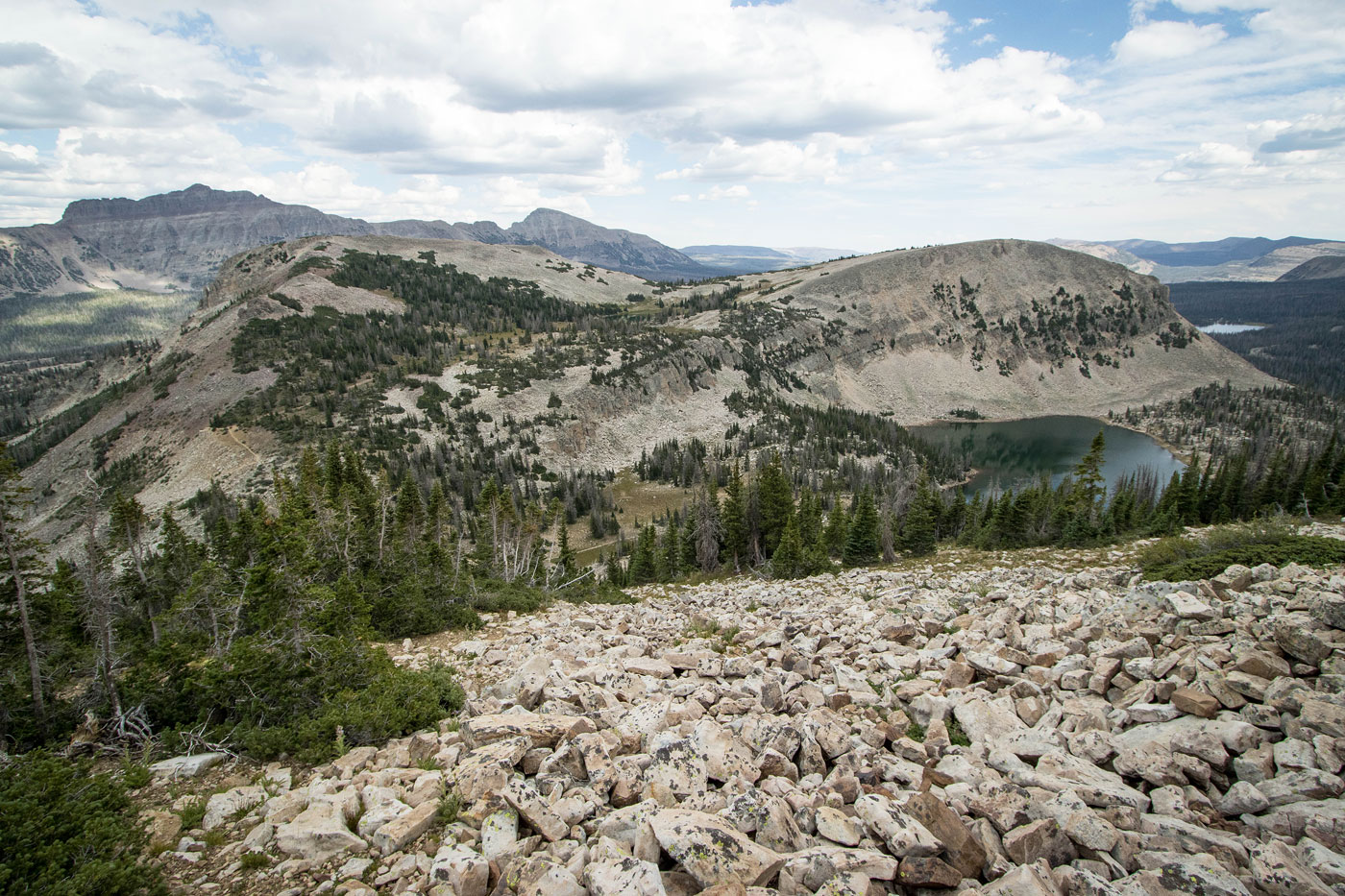
Rather than continue along the trail down to Lofty Lake, I made a detour over Peak 11158, a rocky hump that actually had excellent views. The ridgeline ascent had lots of Class 2 boulder-hopping, and rather than stick to the crest on my way down on the other side, I dropped onto a grassy slope that brought me back to the Lofty Lake Trail. The views continued to be excellent and it was clear why this trail is as popular as it is.
Soon I reached the base of Mount Marsell, where I pondered briefly why I'm incapable of just enjoying a nice loop hike and instead feel the insatiable need to get to some high point. Leaving the trail again, I headed up the steep southeast slope of the peak. I pretty much followed the same route up and back since keeping too far to the right felt more like bushwhacking and too far left had excessive boulders. There's a sweet spot that worked wonderfully and I was soon on the ridgeline of Mount Marsell, which was clear of trees until the summit. Unfortunately the views were minimal up top, but they were the best of the day on the way up.
Back on the Lofty Lake Trail, I descended past Kamas Lake and continued through the forest. I kept left at the Cuberant Lake Trail junction, passed some more small lakes, and then emerged into Reid's Meadow, a delightful viewpoint of Reids Peak with a gorgeous foreground. The trail then ascended a bit back to the trailhead, completing the loop.
Please consider helping me out if you find my site useful. I'm not sponsored, so all site fees are out-of-pocket and my time preparing these trip reports is unpaid. You can also hire me as a web developer. I really appreciate it!


If you find my site helpful, please help me replace my many broken cameras, fund my website fees (hosting, APIs, security), or just support my countless hours of work. I pay for all expenses myself, and all trip reports I post are unpaid and unsponsored, so any support is really appreciated!
If using PayPal, please select their option for "Sending to a friend" so they don't take out fees, thank you.
My site is free to use, but consider sending me a few bucks to help keep it running. Thanks in advance!