Sep 27, 2019 — After spending a few days in this area doing Fish Lake Hightop and Hilgard Mountain, I returned to check out Mt. Marvine and Mt. Terrill to feel like I really got a sense of the Fish Lake region. These are a pair of of peaks that jut out from the rolling meadow-filled landscape. Mt. Marvine requires a scramble to its rocky summit, while Mt. Terrill is a long and mellow slope to the top of a plateau. The route I took to approach both peaks comes from the east along the Black Flat Trail. I wanted to make this a longer day to see some of the tarns visible on a map, as well as enjoy the fall aspens changing colors. My route can be shortened significantly if you drive in from the west to 38.6823165,-111.6357956, but I can't speak for the road conditions coming from this way.
I didn't realize it, but the "Black Flat Trail" is an ATV route, not a singletrack trail. Normally I steer clear of these because I prefer hiking trails to dirt roads, but I already made it to the trailhead and decided to just carry on. It seems like the Black Flat Trail actually got a bit of a re-route somewhat recently, as the roads are marked differently on Google Maps. I started out hiking along a closed section of ATV trail, following a deteriorated doubletrack around some pretty tarns and converged to the maintained ATV road. I don't know if my route or this ATV road is considered the Black Flat Trail, but whatever, I liked the way I went. I followed this ATV road the entire way to the UM Pass (the pass separating Mt. Marvine and Mt. Terrill).
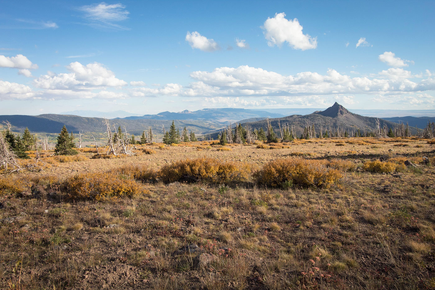
From the UM Pass, I headed south to Mt. Marvine first, following its northern ridge through some light bushwhacking before reaching a fairly large boulder field at Mt. Marvine's eastern base. I boulder-hopped until I passed the southernmost section of Mt. Marvine's well-fortified summit cliffs. I located a reasonable-looking Class 2+ route up the boulders, leading to the southern side of the cliffs. Maybe there's a more reasonable way up, but I found myself a little stressed out on very loose scree on the steep slope. For this reason, I'd call this section Class 3, even though there are no climbing moves. Finally on the ridge, I worked around the west side of Mt. Marvine until I got to the northernmost side of the cliffs, where a short Class 3 move led to the summit. Basically, the route I chose required me to wrap around the entirety of Mt. Marvine.
Back at UM Pass after coming back from Mt. Marvine, I started north toward Mt. Terrill. This route starts out a bit tedious, with lots of boulder-hopping and some minor bushwhacking along the southern slope. I mostly hugged the cliffy rim on the right, where the views toward Mt. Terrill and back toward Mt. Marvine were really neat. It seems like the bushwhacking is worse the closer to the cliffs you get, but I'm not sure. Eventually the trees disappeared and I was greeted by a much more pleasant grassy slope that led to the summit of Mt. Terrill.
On Mt. Terrill, I decided to drop down to the east to a shallow saddle and follow a faint trail rather than heading back the way I came. However, it looked like it could potentially be pretty rocky and unpleasant from above. I love my loops, and preferred to not have to bushwhack back down, so I risked it and am ultimately glad I did. I started north off from Mt. Terrill to avoid its sketchy-looking eastern face, and found a reasonable way down the rocky slopes. It ended up being a really nice side trip, only a few hundred feet requiring some boulder-hopping just before getting to the saddle. The rest of the time, I was pleasantly surprised to find I could hike down and avoid most of the rock outcroppings. Once at the saddle, I was a little annoyed to find the trail was not super obvious, but plenty of social trails led me south down the grassy descent. An old dirt road materialized at about the halfway point, and I followed this back to the Black Flat Trail.
Please consider helping me out if you find my site useful. I'm not sponsored, so all site fees are out-of-pocket and my time preparing these trip reports is unpaid. You can also hire me as a web developer. I really appreciate it!


If you find my site helpful, please help me replace my many broken cameras, fund my website fees (hosting, APIs, security), or just support my countless hours of work. I pay for all expenses myself, and all trip reports I post are unpaid and unsponsored, so any support is really appreciated!
If using PayPal, please select their option for "Sending to a friend" so they don't take out fees, thank you.
My site is free to use, but consider sending me a few bucks to help keep it running. Thanks in advance!