I provide a free route map, but you can also download a hike/drive GPX to assist you and to help support my site. Before sharing my GPX tracks with others, please remember my site is a free resource and I'm charging nominal fees to offset my substantial costs.
GPX track added to your cart.
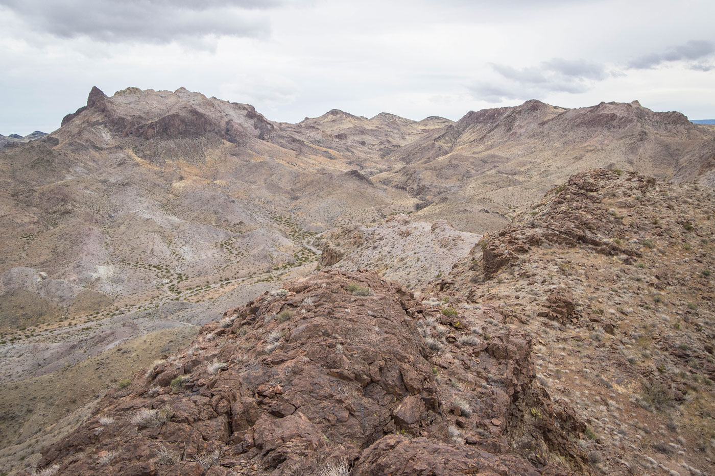
Mar 20, 2023 — Pinto Benchmark and Peak 2755 are two uncommonly visited peaks, likely because it requires significant open desert mileage to reach them. They're pretty minor summits, but both have some cool highlights. My main objective was Pinto Benchmark, but I decided to approach it from the northeast since it would allow me to also reach Peak 2755 more easily. You might want to shorten the hike a bit by coming in from the south using a similar approach as Devils Thumb if you don't care to visit Peak 2755. In fact, Pinto Benchmark was put on my radar after seeing it from Devils Thumb, its colorful-looking summit piquing my interest.
Though much of this hike is located within the Nellis Wash Wilderness, the peaks I hiked are not located within the wilderness, and the wash I used was not the actual named Nellis Wash. Despite being a pretty major drainage, it doesn't seem to even have a name. The Nellis Wash Wilderness is a small wilderness area that hugs the more exciting Spirit Mountain Wilderness to the south. To reach the trailhead, take the Powerline Road leading southeast here (35.47759, -114.80052). Any car can make it. I parked at a junction so I was out of the way of passing traffic.
I headed through rocky desert terrain, debris left behind by the wash. I soon made it to easier hiking within the wash proper, which wiggled a bit and had plenty of little offshoots. On my descent I was able to better stick to the path of least resistance, so I only included that option in my attached map.
After almost two miles, I reached a junction within the wash, where I kept to the right in order to more easily approach the eastern slope of Peak 2755 since its south side looked steep and cliffy. This proved a good idea since the ascent slope was straightforward Class 2, leading to a really nice Class 2/3 knife-edge. Despite the hefty windy trying to knock me off, I found this short scramble delightful and unexpected. The summit is really just a little nubbin without inspiring views, so I continued onward along the crest, hoping I could find a way down on the opposite side since the north and south faces of Peak 2755 are pretty serious-looking. A short Class 3 down-climb along the crest led to a steep, loose Class 2 slope that brought me back into the main wash I'd left earlier.
To reach Pinto Benchmark I thought I'd attempt a route up its north side. From here it looked to be surrounded by cliffs, but I thought I might get lucky, and fortunately that ended up being the case. I took a minor drainage leading south, some Class 2 obstacles and avoidable dryfalls along the way. A possible weakness between two sheer cliffs was my goal, but I knew it could just be an impassable face. After side-hilling for a short time to reach this weakness, I was happy to find I only needed to pull a single tough unexposed Class 3 move to overcome a small cliff band. Past this, Class 2 led on boulders up to an easy slope, and then into the colorful, volcanic terrain that composes Pinto Benchmark. I took the slope up to the summit block, which required some pleasant Class 3. The views were nice, the Colorado River below and Spirit Mountain poking up in the distance. I also thought the bright whites and yellows of the pyroclastic slickrock surrounding me was unique for this immediate area.
Rather than backtrack, I wanted to see more of this sweet desert lump, so I headed west for a short time before deciding my best course of action was to descend via a Class 2 slope. This slope made a descending traverse, and I chose a gully that looked like it would avoid steep and likely-impassable terrain. In hindsight, I wish I'd stayed along the upper ridgeline for longer to see more of the colors up there, but the intense wind made me quite miserable. My chosen route was fine, Class 2/3 leading though narrow obstacles and down into the upper reaches of the main wash I'd used for most of the ascent from my car.
The wash was much more interesting higher up. Sections of scrambling led through minor narrows. I unfortunately saw an owl with a broken wing, surely too far out here for wildlife personnel to come help (though I did report it when I got service). I also passed an unexpected spring, unlabeled on any maps that I could find. The spring created a cute little stream of water, but also hosted some horrible brush that I was able to avoid. The wash opened up into what I'd been hiking through earlier, and I passed the spot where I'd crossed the wash to get from Peak 2755 to Pinto Benchmark. From here it was a straight shot back to the car. As the sun finally started coming out of the clouds, I was able to enjoy the first tufts of wildflowers I'd seen for the year, very much welcomed after a cold and rainy desert winter.
Please consider helping me out if you find my site useful. I'm not sponsored, so all site fees are out-of-pocket and my time preparing these trip reports is unpaid. You can also hire me as a web developer. I really appreciate it!


If you find my site helpful, please help me replace my many broken cameras, fund my website fees (hosting, APIs, security), or just support my countless hours of work. I pay for all expenses myself, and all trip reports I post are unpaid and unsponsored, so any support is really appreciated!
If using PayPal, please select their option for "Sending to a friend" so they don't take out fees, thank you.
My site is free to use, but consider sending me a few bucks to help keep it running. Thanks in advance!