I provide a free route map, but you can also download a hike/drive GPX to assist you and to help support my site. Before sharing my GPX tracks with others, please remember my site is a free resource and I'm charging nominal fees to offset my substantial costs.
GPX track added to your cart.
Mar 27, 2021 — Providence Benchmark is a big mountain at the southern end of Mojave National Preserve. It seems to be overlooked due to its proximity to its taller siblings to the north, Edgar and Mitchell. I thought it was a really pleasant hike, likely my favorite in the Preserve. Most seem to access the peak by taking a long and bad road from the east, but TJ and I opted to head in from the southwest. We drove in on Kelbaker Road and turned off here (34.83451, -115.6246), where low-clearance wouldn't have any problems until about a mile in due to a bad drainage crossing. This would add an extra mile round trip. The road gets rockier here (34.84599, -115.60646), and also appears to be a widlerness boundary, but it's not. There's just a faded sign that says not to drive in the wash, and to stay to the road. This rockier section of road only lasts a half mile before reaching the true wilderness boundary.
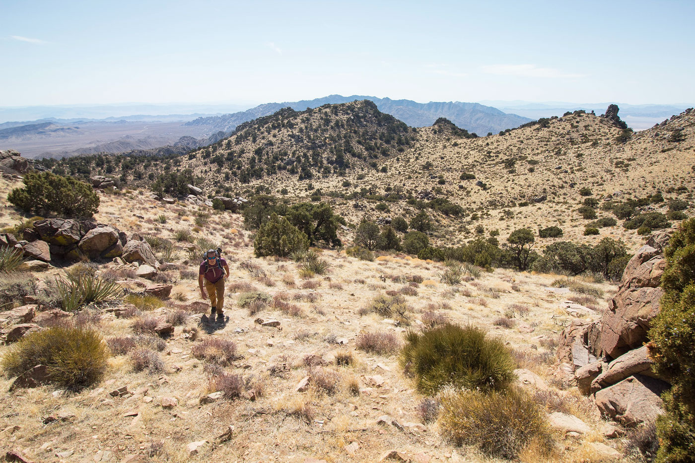
We set out to the north on a very eroded road until it disappears, hiking over a bunch of little bumps and drainages until we dropped down onto a different eroded road that headed directly east. From here we could see the rock outcrops that marked the ridgeline of Providence Benchmark. We followed the road until it faded away and started ascending a steep sloping ridge. It progressively introduced more boulders and sand and steep terrain, but never exceeded Class 2. There were a couple of spots where rock outcrops got a bit more serious, but keeping to the right avoided anything scary. A couple of spots were steep and loose enough due to the coarse sand that we took turns as not to kick rocks on each other. We crested the southern ridge of Providence Benchmark and headed northeast toward the summit. There's an option to stick to the ridgeline, but we decided to side-hill on an easy slope in order to skip the additional vertical gain on the rockier terrain. Past this side-hill slope was a wide and sweeping meadow-like section, my favorite spot of the hike. It felt like a unique landscape for the Mojave, trees spattered around and taller grasses mixed with cacti leading us for another half mile to the summit. Along the way we passed an old mining shaft. The summit views were great.
Please consider helping me out if you find my site useful. I'm not sponsored, so all site fees are out-of-pocket and my time preparing these trip reports is unpaid. You can also hire me as a web developer. I really appreciate it!


If you find my site helpful, please help me replace my many broken cameras, fund my website fees (hosting, APIs, security), or just support my countless hours of work. I pay for all expenses myself, and all trip reports I post are unpaid and unsponsored, so any support is really appreciated!
If using PayPal, please select their option for "Sending to a friend" so they don't take out fees, thank you.
My site is free to use, but consider sending me a few bucks to help keep it running. Thanks in advance!