I provide a free route map, but you can also download a hike/drive GPX to assist you and to help support my site. Before sharing my GPX tracks with others, please remember my site is a free resource and I'm charging nominal fees to offset my substantial costs.
GPX track added to your cart.
Aug 16, 2022 — Salt Creek Peak is a high-prominence mountain just east of the I-15. Most who summit seem to prefer driving on bad roads from the southeast, but I really wanted to find a way to hike up to its summit instead rather than spend a bunch of extra time in a car. A topo map hinted at a trail coming from the north, but I suspected it might be out of commission, though I decided to risk a potential bushwhack because I guess I hate myself or something. Any car can make it to where I parked, which was just before a creek crossing. I wasn't willing to drive through it and mess up my car the first day of my trip, but if you drive across the creek and continue on a powerline road you can cut two miles off my hike stats.
After hiking along the powerline road, I took a left at a spur road that climbed to a minor ridge to the east and then disappeared. From here I headed south toward the peak, where the possible remains of the trail is clearly maintained only now maintained by cow erosion. When the cattle trail became difficult to follow at times, it wasn't really a problem because the terrain was mostly clear of brush. I never found myself fighting to make progress, though sometimes I had to dodge a few brushy patches.
As the slope steepened at around 7400', tightly switchbacking trail remains materialized for a while, but little animal trails kept popping in and led elsewhere. When ascending this steep section, I recommend trying to keep generally to the left of the brownish/red conglomerate rock above, not falling prey to the confusing trails that so temptingly lead in a less vertical fashion. Eventually the trail did become more clear for a short time as I continued into a forested section. The brush was encroaching just a little bit more and then the deadfall began. With a little effort I was able to find an animal trail that avoided most of the obstacles. On the way back, it was actually somehow a lot easier to stay on any sort of trail, so I can confirm there is one, though it's not great most of the time. Hints of trail segments persisted up the ridgeline. As I made my way up there were definitely sections that required stepping over deadfall and navigating around brush, but it still wasn't annoying enough to call it true bushwacking.
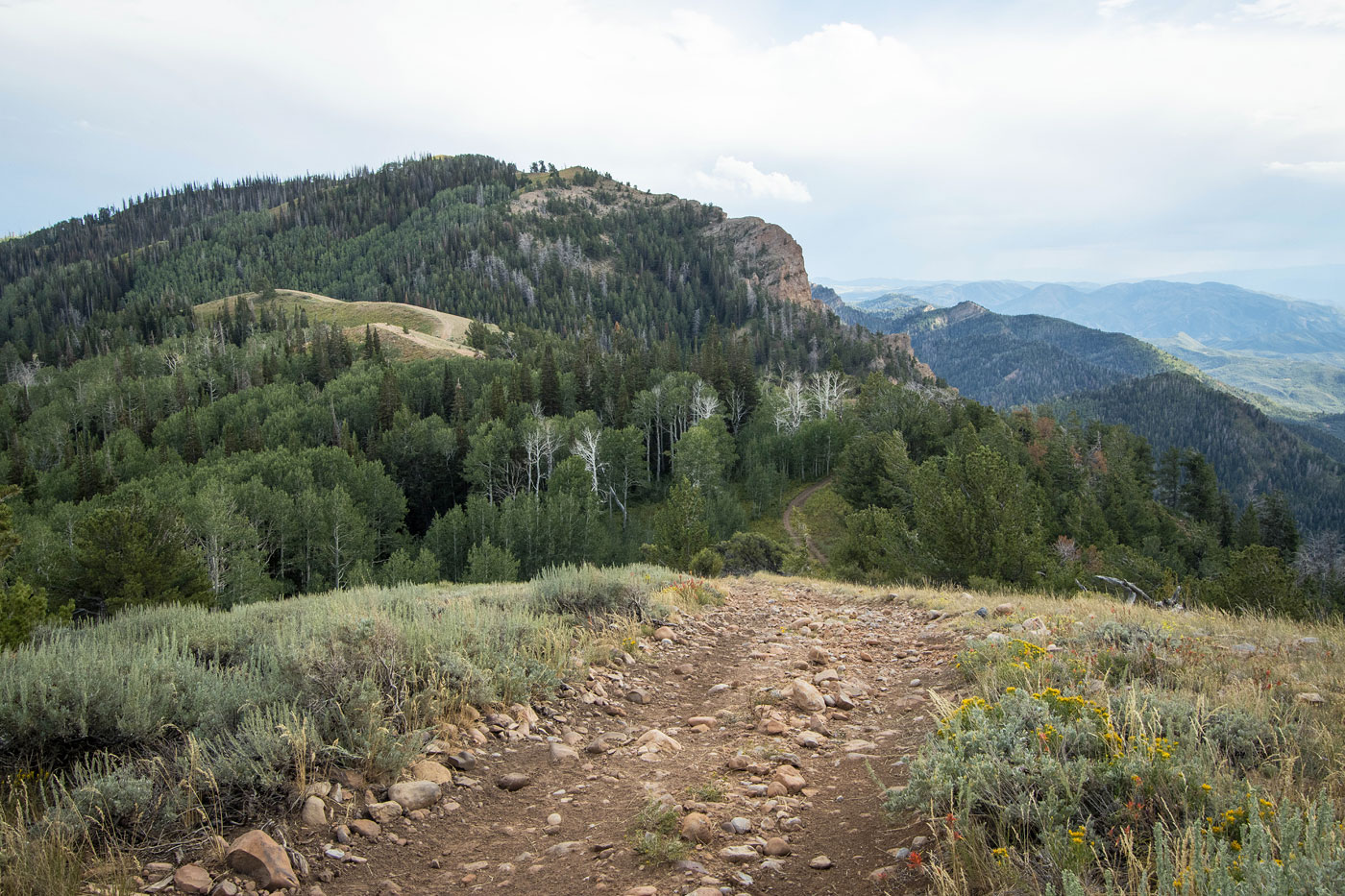
I stumbled onto an ATV road on the northeast side of a small bump. The ATV road continued along the ridge crest, easing travel effort significantly. I marked this spot on my map so you know when the hike will ease up. From here the views become really nice and I was happy to make some quicker walking time. The ATV road drops a hundred feet, then climbs to just below the summit. Before it started to descend again, I left the road to ascend the mostly grassy north ridge of Salt Creek Peak, which actually had a decent social trail. I was pretty happy I did this more adventurous ascent of this peak that's otherwise known for its grueling drive-up.
Please consider helping me out if you find my site useful. I'm not sponsored, so all site fees are out-of-pocket and my time preparing these trip reports is unpaid. You can also hire me as a web developer. I really appreciate it!


If you find my site helpful, please help me replace my many broken cameras, fund my website fees (hosting, APIs, security), or just support my countless hours of work. I pay for all expenses myself, and all trip reports I post are unpaid and unsponsored, so any support is really appreciated!
If using PayPal, please select their option for "Sending to a friend" so they don't take out fees, thank you.
My site is free to use, but consider sending me a few bucks to help keep it running. Thanks in advance!