

From the trailhead, heading toward the peaks. Seen ahead are South Maria (left) and Peak 2905 (center).
View back toward the trailhead.
Ascending our gully of choice to reach the saddle above.
Lots of Class 2 and low Class 3 boulder-hopping obstacles.
View back down the gully.
A narrow section higher up.
View back down the gully.
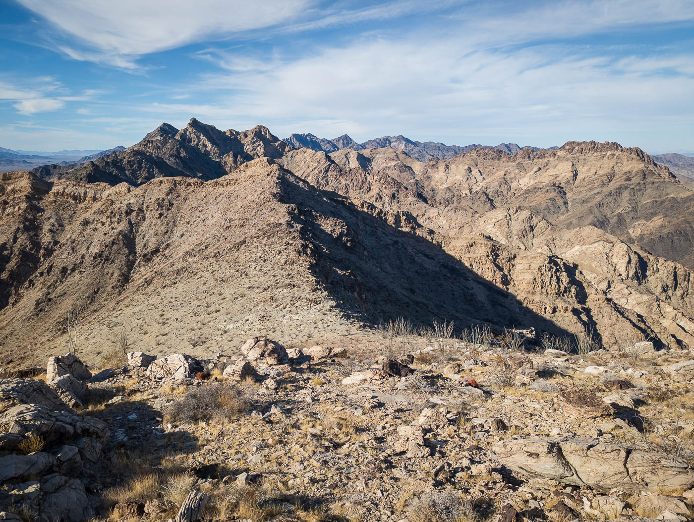
Peak 2905 seen over there.
Along the ridgeline to Peak 2905.
Final scramble to the summit.
Peak 2905 summit, view southeast. You can see both Peak 2575s, our last two for the day (left and far right).
On the way down from Peak 2905. Peak 2685 seen top right, the hardest peak of the day.
Heading over to South Maria, seen right of center.
On the way up South Maria.
South Maria summit, view back toward Peak 2905.
Close-up toward Peak 2685.
View back up toward South Maria.
Descending traverse to the saddle, Peak 2631 seen center.
Headed up to Peak 2631 from the saddle.
Some light scrmabling.
Onward from Peak 2631.
Peak 2685 left of center.
Some obstacles along the ridgeline.
A Class 3 sketchier section along the ridgeline.
View back at the sketchy section.
Some scrambling in and out of dips along the ridgeline.
View back at our progress along the ridgeline so far.
Bypassing a sketchy section along the crest.
A Class 3 bit.
An example of a Class 4 spot that can be avoided by dropping around various outcroppings.
Peak 2685 seen ahead.
Avoidable Class 3 stuff if you prefer to skip it.
View back at a scrambly section.
View back. Big Maria seen top right.
Making our way to the base of Peak 2685.
Keeping left of the crest initially.
Then some Class 3 on the ridgeline.
Summit ahead, separated by a notch.
Class 3+ chimney into the notch.
Tyler coming down the Class 3+ chimney.
View back from within the notch.
Summit of Peak 2685, view toward Peak 2575, our next peak (right of center).
Starting down from Peak 2685. There's likely better descent gully options than the one we chose.
Our chosen descent used a series of gullies.
Class 3+ on the way down.
A Class 3+ dryfall.
Getting lower, still more dryfall obstacles.
View back up toward Peak 2685 when we reached the wash below.
Continuing down the wash.
View back toward Peak 2685 (top right).
Our chosen ascent gully to get up to Peak 2575.
Lots of boulder-hopping.
A narrow section with fun obstacles.
Class 3 dryfalls.
Solid rock and good holds within the drainage.
We emerged from the drainage and continued up the slope. Peak 2685 seen top center.
Summit of Peak 2575, view toward Peak 2905 and South Maria (left of center), and Peak 2685 (far right).
Wide shot from the summit of Peak 2575.
View east toward Tosco Benchmark.
View of the southern cliff face.
The second Peak 2575 seen center, our final peak of the day.
View back toward Peak 2575 as we approach Peak 2575 (same name since same elevation).
Class 2/3 up to Peak 2575.
Fun slabs and scrambly sections.
Tyler on the summit of Peak 2575. Tosco Benchmark right of center.
Peak 2575 summit, view toward South Maria.
We descended to an old mining road left of the wash, which we took back to the cars.
Hire me or show me some love!
Hire/refer me as a web developer or send me a few bucks if you find my site useful. I’m not sponsored, so all fees are out-of-pocket and my time preparing trip reports is unpaid. I really appreciate it!