

I hiked along the dirt road for a short time before deciding to head left up a spur ridge to get to Square Top Mountain (left). Jackson Peak visible top right.
Square Top Mountain, minimal brush on the way to its base.
Making progress to Square Top Mountain. There's a lightly forested section ahead.
View back along a fenceline as I make my way to Square Top Mountain.
Southern slope of Square Top Mountain.
Class 2 and steep.
View back, Signal Peak visible in the distance.
Steep and loose at times, with some talus.
Class 2 up the slope.
Nearing the Square Top Mountain ridgeline.
Square Top Mountain high point ahead.
Close up of Square Top Mountain's high point.
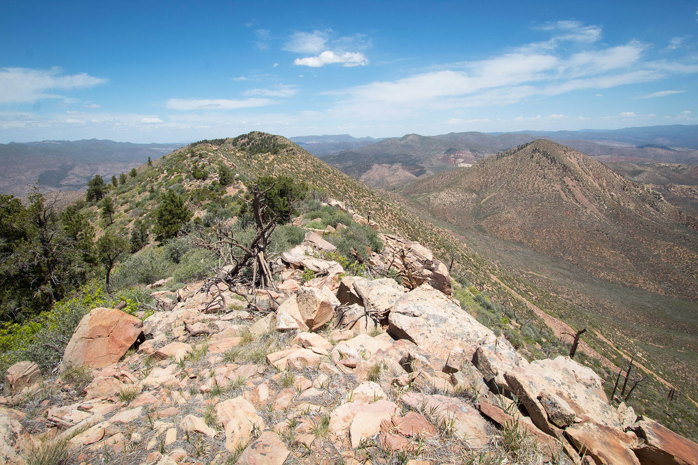
Square Top Mountain summit, view back along the ridge.
I continued along the ridge, heading northeast.
Along the Square Top Mountain ridgeline, on my way toward Jackson Peak.
View back toward Square Top Mountain from the northeast end of the ridge.
View north toward the Bull Valley Mountains.
View east toward Jackson Peak. It's a steep descent to the saddle.
View back up the descent from Square Top Mountain.
Jackson Peak ahead.
Base of Jackson Peak.
On my way up Jackson Peak, view back toward Square Top Mountain and the saddle I ascended from. On my map, I noted the saddle as being a possibly better descent back to the dirt road, but you can see how brushy it is in this photo.
Class 2 to Jackson Peak.
Jackson Peak, view toward Square Top Mountain.
Jackson Peak, view north.
Jackson Peak, view southwest. Square Top Mountain right, West Mountain Peak back left.
Jackson Peak, view toward Signal Peak (top left) and Snow Canyon State Park (far right).
Close-up down from Jackson Peak toward the dirt road (right of center) that I wanted to get down to. I chose to beeline it from the summit. Not sure it was a good choice. Also not sure what would be better. Maybe descending from the Square Top Mountain / Jackson Peak saddle into the drainage visible on the right?
View back toward Jackson Peak as I descended the loose, steep bad descent.
Nearing the bottom of the descent from Jackson Peak.
Brush at the base of the peak.
Lots of brush, view back toward Jackson Peak.
I made it to the bad dirt road, view back to Jackson Peak.
I followed the road back to my car.
Hire me or show me some love!
Hire/refer me as a web developer or send me a few bucks if you find my site useful. I’m not sponsored, so all fees are out-of-pocket and my time preparing trip reports is unpaid. I really appreciate it!