I provide a free route map, but you can also download a hike/drive GPX to assist you and to help support my site. Before sharing my GPX tracks with others, please remember my site is a free resource and I'm charging nominal fees to offset my substantial costs.
GPX track added to your cart.
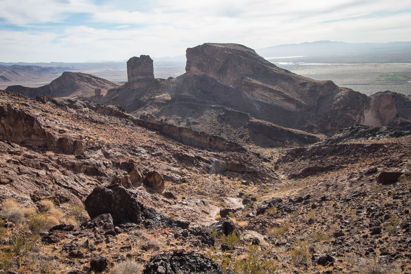
Dec 07, 2020 — Matt and I set out for the southern end of the Havasu National Wildlife Refuge to see Dead Burro Canyon and the peaks in the area. We turned off at 34.60413811340223, -114.36389520379934 and followed the progressively more sandy road until we reached our start point. I'd say 2WD shouldn't have an issue with some momentum. There was an RV parked next to us, after all. We continued along the road (which became an ATV road) and onto a wide mesa-like hill. The road continued west and dropped down into a major wash, reascending on the opposite side. A burro trail led us down to the mouth of Dead Burro Canyon. We intended to head up the canyon, but I think you can only access it by bypassing a major dryfall on the left. We chose to go to the right on a cairned social trail and couldn't find a way back into the canyon from above, the cliffs too sheer. Instead we continued on the gradual slope to Peak 1520, and got some nice views into the canyon from above.
From Peak 1520, we located a Class 2 loose break in the cliff band to the west and continued down to the head of Dead Burro Canyon. We encountered a cairned social trail, likely part of the Dead Burro Loop, an unofficial loop trail that accesses this area. We continued west toward Peak 1460, popping between a big butte reminiscent of Utah's monoliths and a minor pinnacle. We wrapped around to the peak's southern ridge at the base of its cliffs. Class 2 led to the summit, and we couldn't find a reasonable way down on the north/northwest side in order to access the next peak in our route. We backtacked and wrapped around Peak 1460's northeast side, then ascended a Class 2 gully/slope to the saddle of an unnamed/unranked Class 5 peak (left) and Peak 1652 (right). We attempted a route up the unnamed peak, but were cliffed out severely a bit below the summit. We bailed and continued onward to Peak 1652, side-hilling on the right of the cliffy ridge crest. We made it to the summit via a Class 2 drainage.
The ridgeline from Peak 1652 to its saddle with Peak 1665 was the most interesting portion of the route, I thought. From the summit of Peak 1652, stay directly on the ridge crest to locate a Class 2 break in the cliff band. The descent was slabby and slanted, creating lots of Class 2/2+ fun. The ascent to Peak 1665 was easy Class 2, and the views toward The Needles and Tumarion Peak were quite nice from here. The cliffs on the east face of Peak 1665 were daunting, so we instead headed down the peak's south slope, where there were some Class 2 obstacles. Following the ridgeline required us to ascend a minor hill, and then descend on a slope with colorful rock into the drainage separating Peak 1665 from Peak 1520 (our first peak of the day). We continued generally southeast in a significant wash, eventually merging with an ATV road. The road took us back up the wide mesa/hill and then back down to our cars.
Please consider helping me out if you find my site useful. I'm not sponsored, so all site fees are out-of-pocket and my time preparing these trip reports is unpaid. You can also hire me as a web developer. I really appreciate it!


If you find my site helpful, please help me replace my many broken cameras, fund my website fees (hosting, APIs, security), or just support my countless hours of work. I pay for all expenses myself, and all trip reports I post are unpaid and unsponsored, so any support is really appreciated!
If using PayPal, please select their option for "Sending to a friend" so they don't take out fees, thank you.
My site is free to use, but consider sending me a few bucks to help keep it running. Thanks in advance!