stav is lost logo
  • Find Hikes
    • Most recent
    • Trip Report Index
    • Hikes by Region
    • Search Hikes
  • Map
  • About
  • Love
Hike Mount Aire in Uinta-Wasatch-Cache National Forest, Utah - Stav is Lost

Hike Mount Aire Uinta-Wasatch-Cache National Forest, UT

Class 1 3.9 miles 2100 gain 2-4 hrs Out and Back
Effort
Beauty
Personality
Solitude
DirectionsRoute MapDownload GPX

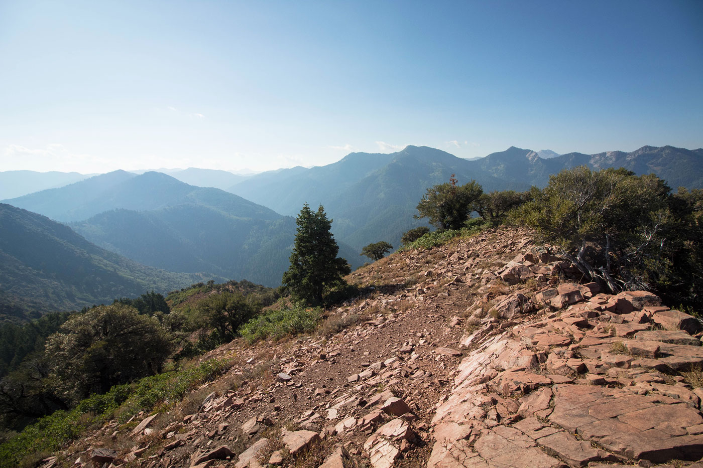
Sep 09, 2019 — Mount Aire is a popular summit in the Wasatch Mountains. A trail leads the entire way to its summit. There is a small fee for driving up Mill Creek Canyon Road. This pleasant hike starts through typical Wasatch forest scenery, leading to a saddle just south of Mount Aire. This saddle has some nice views. Switchbacks continue north to the summit, and a final ridge ascent free of trees has some nice views. In addition to the lovely surrounding green hills, of note is the Wildcat Ridge visible to the south.

PEAKS ON HIKE
Elevation (ft) / Prominence (ft)
Peaks on hike
Elevation
Prominence
1
Mount Aire
8621 ft
581 rise

Show me some love

Please consider helping me out if you find my site useful. I'm not sponsored, so all site fees are out-of-pocket and my time preparing these trip reports is unpaid. You can also hire me as a web developer. I really appreciate it!

Thank you

Next HikePrev Hike
  • Next Hike
  • More Near Here
  • Prev Hike
photo protector Mount Aire Trailhead.
Mount Aire Trailhead.
photo protector Heading through the forest on a nice trail.
Heading through the forest on a nice trail.
photo protector View back.
View back.
photo protector Ascending along the trail. Nothing too notable, just pretty forest.
Ascending along the trail. Nothing too notable, just pretty forest.
photo protector At the saddle south of Mount Aire, view back the way we came.
At the saddle south of Mount Aire, view back the way we came.
photo protector Ascending the final switchbacks to Mount Aire's summit.
Ascending the final switchbacks to Mount Aire's summit.
photo protector Along the switchbacks, some nice views along the way.
Along the switchbacks, some nice views along the way.
photo protector View back toward the saddle.
View back toward the saddle.
photo protector No caption.
photo protector Mount Aire summit ahead.
Mount Aire summit ahead.
photo protector Mount Aire summit, view east.
Mount Aire summit, view east.
photo protector Mount Aire summit, view south back the way we came.
Mount Aire summit, view south back the way we came.

Show Me Some Love

If you find my site helpful, please help me replace my many broken cameras, fund my website fees (hosting, APIs, security), or just support my countless hours of work. I pay for all expenses myself, and all trip reports I post are unpaid and unsponsored, so any support is really appreciated!

If using PayPal, please select their option for "Sending to a friend" so they don't take out fees, thank you.

PayPalVenmoCash App

About  Contact  Love

© 2023 Stavros Basis.

DISCLAIMER: All activities you find on this site are dangerous. I am not responsible for anything you do in the outdoors. Please practice good ethics, and don't take any risks that put yourself or others in danger.


Thanks for visiting!

My site is free to use, but consider sending me a few bucks to help keep it running. Thanks in advance!

Sure!Nope.